IMAGES TAKEN NEAR TO
Lawrenny, KILGETTY, SA68 0QA
Introduction
This page details the photographs taken nearby to SA68 0QA by members of the Geograph project.
The Geograph project started in 2005 with the aim of publishing, organising and preserving representative images for every square kilometre of Great Britain, Ireland and the Isle of Man.

There are currently over 7.5m images from over14,400 individuals and you can help contribute to the project by visiting https://www.geograph.org.uk
Image Map
Images are licensed for reuse under creativecommons.org/licenses/by-sa/2.0
Notes
- Clicking on the map will re-center to the selected point.
- The higher the marker number, the further away the image location is from the centre of the postcode.
Image Listing (15 Images Found)
Images are licensed for reuse under creativecommons.org/licenses/by-sa/2.0
Image
Details
Distance
2
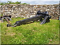
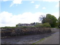
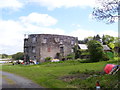
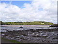
Coedcanlas - Old Large House - Big Anchor by gate
Image: © welshbabe
Taken: 18 May 2015
0.02 miles
4
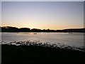
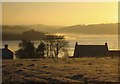
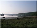
Sunrise over Coedcanlas from Black Tar
Image: © Shaun Butler
Taken: 28 Dec 2008
0.03 miles
6
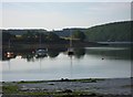
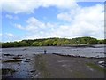
Mid river
Looking across the divide to South Pembrokeshire.
Image: © Deborah Tilley
Taken: 10 Apr 2011
0.08 miles
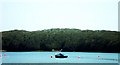
9
Port Lion pool at dawn
On the foreshore at Llangwm Ferry looking across Port Lion Pool to Benton Wood, and the Eastern Cleddau in the distance.
Image: © Shaun Butler
Taken: 27 May 2004
0.19 miles