IMAGES TAKEN NEAR TO
Begelly, KILGETTY, SA68 0PB
Introduction
This page details the photographs taken nearby to SA68 0PB by members of the Geograph project.
The Geograph project started in 2005 with the aim of publishing, organising and preserving representative images for every square kilometre of Great Britain, Ireland and the Isle of Man.

There are currently over 7.5m images from over14,400 individuals and you can help contribute to the project by visiting https://www.geograph.org.uk
Image Map
Images are licensed for reuse under creativecommons.org/licenses/by-sa/2.0
Notes
- Clicking on the map will re-center to the selected point.
- The higher the marker number, the further away the image location is from the centre of the postcode.
Image Listing (3 Images Found)
Images are licensed for reuse under creativecommons.org/licenses/by-sa/2.0
Image
Details
Distance
1

The road in Carne
Confusingly (to me) there are two places called Carne, in different squares.
Image: © David Medcalf
Taken: 10 Aug 2022
0.07 miles

3
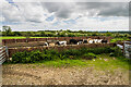
The WWII remains of RAF Templeton (2)
-
SBA Main Beacon walled enclosure
Now in use for cattle, it once contained the main radio transmitter beacon for the airfield at Templeton of the Standard Beam Approach blind landing radio navigation system. It formed part of a system of three beacons in line with the main runway (Main, Inner, and Outer) that assisted aircraft landing at night or in poor visibility.
The walled enclosure is rectangular, and is open at the end facing the runway, with a smaller opening at the other. It is aligned exactly to the orientation of the main runway and is approximately 400 metres from the SW end of it. The walled enclosure would have contained a hut housing the transmitter, in front of which was a group of three antennas placed in a line parallel to the end of the runway: https://media.geograph.org.uk/files/7eabe3a1649ffa2b3ff8c02ebfd5659f/SBA_Main_2-original.jpg
The Main Beacon transmitted a signal in the form of a narrow beam. When the pilot was lined up correctly the signal received was steady, if too far to the left or right, the signal received was a stream of dots or dashes that indicated a change of course was required that when corrected, the signal would change to a steady tone. The system continued to be used after the war, but was replaced in the 1950s by ILS (Instrument Landing System).
Google Earth view: https://media.geograph.org.uk/files/7eabe3a1649ffa2b3ff8c02ebfd5659f/RAF_Templeton_SBA_beacon-original.jpg
Image
Image: © Mike Searle
Taken: 6 Jun 2021
0.15 miles