
IMAGES TAKEN NEAR TO
Clyndu Street, SWANSEA, SA6 7BB
Introduction
This page details the photographs taken nearby to Clyndu Street, SA6 7BB by members of the Geograph project.
The Geograph project started in 2005 with the aim of publishing, organising and preserving representative images for every square kilometre of Great Britain, Ireland and the Isle of Man.

There are currently over 7.5m images from over14,400 individuals and you can help contribute to the project by visiting https://www.geograph.org.uk
Image Map
Images are licensed for reuse under creativecommons.org/licenses/by-sa/2.0
Notes
- Clicking on the map will re-center to the selected point.
- The higher the marker number, the further away the image location is from the centre of the postcode.
Image Listing (69 Images Found)
Images are licensed for reuse under creativecommons.org/licenses/by-sa/2.0
Image
Details
Distance
1
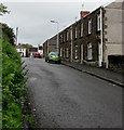
Harris Street, Morriston, Swansea
Viewed from the corner of Morfydd Street looking north towards Crown Street.
Houses on the east side of Harris Street are opposite a grassy bank.
Image: © Jaggery
Taken: 16 Oct 2018
0.06 miles
2
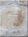
Ordnance Survey Cut Mark
This OS cut mark can be found on the roadside wall to the east of Trewyddfa Road. It marks a point 106.378m above mean sea level.
Image: © Adrian Dust
Taken: 16 Jul 2014
0.07 miles
3
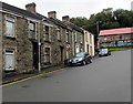
Houses at the western end of Morfydd Street, Morriston, Swansea
On the approach to the Clyndu Street junction.
Image: © Jaggery
Taken: 16 Oct 2018
0.08 miles
4
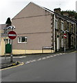
No Entry signs, Banwell Street, Morriston, Swansea
Facing Morfydd Street at the northern end of Banwell Street. https://www.geograph.org.uk/photo/5942839
Image: © Jaggery
Taken: 16 Oct 2018
0.09 miles
5
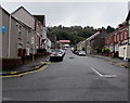
West along Morfydd Street, Morriston, Swansea
Morfydd Street ascends from the B4603 towards Clyndu Street.
Image: © Jaggery
Taken: 16 Oct 2018
0.10 miles
6
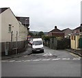
Banwell Street, Morriston, Swansea
The northern end of Banwell Street viewed across Morfydd Street.
Image: © Jaggery
Taken: 16 Oct 2018
0.10 miles
7
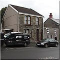
Rosebery Villa, Morfydd Street, Morriston, Swansea
The tablet on the stone house at first floor level shows ROSEBERY VILLA.
In October 2018 there are two front doors, side by side behind the car.
Image: © Jaggery
Taken: 16 Oct 2018
0.12 miles
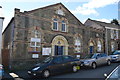
9
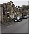
Salvation Army Citadel, Morfydd Street, Morriston, Swansea
The Salvation Army's early meetings in Morriston were held in a room above a cobbler's shop in Clyndu Street before the Corps moved to this building in May 1889.
Image: © Jaggery
Taken: 16 Oct 2018
0.12 miles
10
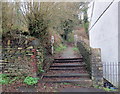
Llwybr Craig Trewyddfa / Craig Trewyddfa Path
Llwybr sy'n cysylltu Heol y Graig â Heol Trewyddfa.
A path linking Graig Road with Trewyddfa Road (trans. settlement of the prominent hill).
Image: © Alan Richards
Taken: 8 Jan 2020
0.14 miles