1
Mill Lane, Narberth
Descending from the A478 in the south of Narberth.
Image: © Jaggery
Taken: 31 Jul 2015
0.02 miles
2
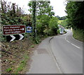
Destinations signs alongside the A478, Narberth
Viewed from the corner of Mill Lane. Ahead for Parc Hamdden, Herons Brook, Golf & Lodges.
A caravan park is 200 yards ahead.
Image: © Jaggery
Taken: 31 Jul 2015
0.03 miles
3
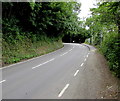
No through road sign and no turning place beyond this point sign, Narberth
At the northern end of the dead-end Mill Lane, facing the A478 junction.
Image: © Jaggery
Taken: 31 Jul 2015
0.03 miles
4
Two warning road signs alongside the A478 in Narberth
On the descent towards Narberth Bridge, the signs warn of a left bend
in the road and two minor road junctions (Valley Road and Mill Pond Road) ahead.
Image: © Jaggery
Taken: 31 Jul 2015
0.03 miles
5
A478 ascends into Narberth
Looking towards the bend opposite the Mill Lane junction.
Image: © Jaggery
Taken: 31 Jul 2015
0.03 miles
6
Gate House Cottage, Narberth
On the west side of the A478, nearly opposite the Mill Lane junction.
Image: © Jaggery
Taken: 31 Jul 2015
0.06 miles
7
Narberth Bridge Business Park, Narberth
Viewed across Mill Pond Road, about 150 metres east of Narberth Bridge http://www.geograph.org.uk/photo/4596312 and the A478.
Image: © Jaggery
Taken: 31 Jul 2015
0.07 miles
8
Mill Pond Road, Narberth
Access road to Narberth Bridge Business Park, Brookside Caravan Park and Castlewood Lodges.
Image: © Jaggery
Taken: 31 Jul 2015
0.08 miles
9
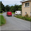
Royal Mail van leaves Narberth Bridge Business Park, Narberth
Heading west towards the A478.
Image: © Jaggery
Taken: 31 Jul 2015
0.08 miles
10
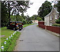
Premier Stove and Fireplaces van, Mill Pond Road, Narberth
Parked alongside the access road to Narberth Bridge Business Park.
Image: © Jaggery
Taken: 31 Jul 2015
0.09 miles


