IMAGES TAKEN NEAR TO
Heol Y Gaer, CLYNDERWEN, SA66 7NB
Introduction
This page details the photographs taken nearby to Heol Y Gaer, SA66 7NB by members of the Geograph project.
The Geograph project started in 2005 with the aim of publishing, organising and preserving representative images for every square kilometre of Great Britain, Ireland and the Isle of Man.

There are currently over 7.5m images from over14,400 individuals and you can help contribute to the project by visiting https://www.geograph.org.uk
Image Map (Loading...)


Getting Data...Please wait
Leaflet Map data © OpenStreetMap
Images are licensed for reuse under creativecommons.org/licenses/by-sa/2.0
Notes
- Clicking on the map will re-center to the selected point.
- The higher the marker number, the further away the image location is from the centre of the postcode.
Image Listing (64 Images Found)
Images are licensed for reuse under creativecommons.org/licenses/by-sa/2.0
Image
Details
Distance
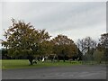
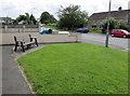
1

Heol-y-gaer, Clunderwen
Cul-de-sac on the east side of the A478, the main road through the village.
Image: © Jaggery
Taken: 15 Aug 2015
0.02 miles
2
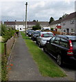
Pavement and cars, Heol-y-gaer, Clunderwen
Heol-y-gaer http://www.geograph.org.uk/photo/4617686 is a cul-de-sac on the east side of the A478, the main road through the village.
Image: © Jaggery
Taken: 15 Aug 2015
0.02 miles
3
Caution children playing sign in Clunderwen
At the western end of the cul-de-sac Heol-y-gaer, http://www.geograph.org.uk/photo/4617686 facing the A478, the main road through the village.
Image: © Jaggery
Taken: 15 Aug 2015
0.04 miles
4
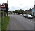
Warning sign - playground ahead, Clunderwen
Alongside the A478, the main road through the village, on the approach to Clunderwen Playing Field.
Image: © Jaggery
Taken: 15 Aug 2015
0.04 miles
5
Roadside bench, Clunderwen
Facing the A478 near the corner of Heol-y-gaer. http://www.geograph.org.uk/photo/4617686
Image: © Jaggery
Taken: 15 Aug 2015
0.05 miles
6
Heol, Clynderwen
Even small villages have council estates.
Image: © Humphrey Bolton
Taken: 5 Oct 2007
0.05 miles
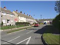
7
Main road houses in Clunderwen
Like many of the houses in the village, these are alongside the A478, the main road through Clunderwen.
Image: © Jaggery
Taken: 15 Aug 2015
0.05 miles
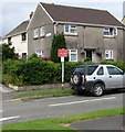
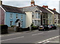
8
Two bungalows in Clunderwen
On the east side of the A478, the main road through the village.
Image: © Jaggery
Taken: 15 Aug 2015
0.05 miles
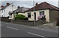
9
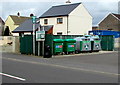
Clunderwen Recycling Point
Alongside the A478, the main road through the village. The two green wheelie bins on the left
are for mixed recycling (paper, cans, plastic bottles). The two bins are for glass bottles and jars.
Image: © Jaggery
Taken: 15 Aug 2015
0.05 miles