
IMAGES TAKEN NEAR TO
Sybil Street, SWANSEA, SA6 5FA
Introduction
This page details the photographs taken nearby to Sybil Street, SA6 5FA by members of the Geograph project.
The Geograph project started in 2005 with the aim of publishing, organising and preserving representative images for every square kilometre of Great Britain, Ireland and the Isle of Man.

There are currently over 7.5m images from over14,400 individuals and you can help contribute to the project by visiting https://www.geograph.org.uk
Image Map
Images are licensed for reuse under creativecommons.org/licenses/by-sa/2.0
Notes
- Clicking on the map will re-center to the selected point.
- The higher the marker number, the further away the image location is from the centre of the postcode.
Image Listing (21 Images Found)
Images are licensed for reuse under creativecommons.org/licenses/by-sa/2.0
Image
Details
Distance
1
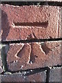
Ordnance Survey Cut Mark
This OS cut mark can be found on the Post Office, No43 High Street. It marks a point 27.938m above mean sea level.
Image: © Adrian Dust
Taken: 28 Dec 2013
0.05 miles
2
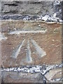
Ordnance Survey Cut Mark
This OS cut mark can be found on No44 Lower Down Road. It marks a point 29.928m above mean sea level.
Image: © Adrian Dust
Taken: 28 Dec 2013
0.07 miles
3
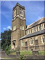
St.Mary's Church, Clydach
St.Mary's Church, founded in 1905.
Image: © Alan Hughes
Taken: 1 Jul 2017
0.11 miles
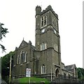
5
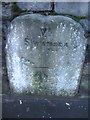
Mile Stone with OS Cut Mark
This Mile Stone, Swansea VI miles, has an Ordnance Survey cut mark which marks a point 26.661m above mean sea level. It can be found in the cemetery wall.
Image: © Adrian Dust
Taken: 28 Dec 2013
0.14 miles
6
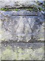
Ordnance Survey Cut Mark
This OS cut mark can be found on the SE face of Clydach Bridge. It marks a point 21.299m above mean sea level.
Image: © Adrian Dust
Taken: 28 Dec 2013
0.16 miles
7
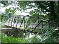
Footbridge over River Tawe at Clydach
This bridge allows access to the playing fields Image on the other side of the river.
Image: © Nigel Davies
Taken: 16 Aug 2009
0.17 miles
8
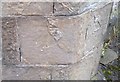
Ordnance Survey Cut Mark
This OS cut mark can be found on the north angle of St John's Church. It marks a point 87.5ft above mean sea level.
Image: © Adrian Dust
Taken: 3 Sep 2020
0.17 miles
9
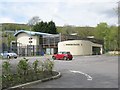
Forge Fach Community Resource Centre, Clydach
See http://www.forgefach.org.uk/ for details
Image: © Nigel Davies
Taken: 6 May 2012
0.17 miles
10
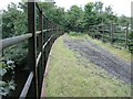
Mineral line bridge over Tawe
The dismantled mineral line that used to run into the Mond refinery (now the Inco works Image) is now blocked off at the works fence. You can still get on to the bridge to look at the river though.
Image: © Nigel Davies
Taken: 16 Aug 2009
0.17 miles