
IMAGES TAKEN NEAR TO
Y Gorlan, GOODWICK, SA64 0BB
Introduction
This page details the photographs taken nearby to Y Gorlan, SA64 0BB by members of the Geograph project.
The Geograph project started in 2005 with the aim of publishing, organising and preserving representative images for every square kilometre of Great Britain, Ireland and the Isle of Man.

There are currently over 7.5m images from over14,400 individuals and you can help contribute to the project by visiting https://www.geograph.org.uk
Image Map
Images are licensed for reuse under creativecommons.org/licenses/by-sa/2.0
Notes
- Clicking on the map will re-center to the selected point.
- The higher the marker number, the further away the image location is from the centre of the postcode.
Image Listing (149 Images Found)
Images are licensed for reuse under creativecommons.org/licenses/by-sa/2.0
Image
Details
Distance
1
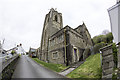
St Peters Church, Goodwick
** Site Description St Peter's church is located on the west side of Plasygamil Road. It was built in 1910-11 to designs of architect E.M.Bruce Vaughan of Cardiff in late Decorated to early Perpendicular Gothic style as espoused by turn-of-the-century church architects following G.F.Bodley, and of unusual elaboration for the region. The church is not aligned east-west but south-west by north-east.
** Info courtesy of Coflein
Image: © Arthur C Harris
Taken: 5 Apr 2017
0.02 miles
2
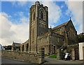
St Peter's Parish Church, Goodwick
A modern church: Goodwick was part of the parish of Llanwnda until 1923, when Goodwick Urban District was formed as a result of the rapid increase in population following the establishment of the transatlantic port.
Image: © Dylan Moore
Taken: 29 Oct 2013
0.04 miles
3
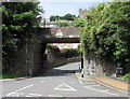
SE side of Duffryn railway bridge, Goodwick
Over the southern end of Main Street, near the Wern Road junction. Headroom shown is 13' 3".
Image: © Jaggery
Taken: 6 Aug 2015
0.05 miles
4
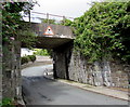
NW side of Duffryn railway bridge, Goodwick
Over the southern end of Main Street, near the A487 Wern Road junction (ahead). Headroom shown is 13' 3".
Image: © Jaggery
Taken: 6 Aug 2015
0.05 miles
5
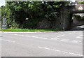
Direction signs on a Goodwick corner
Alongside the A487 Wern Road, signs showing Goodwick Town Centre and Goodwick Industrial Centre
point right towards Main Street. The bridge is Duffryn railway bridge. http://www.geograph.org.uk/photo/4601848
Image: © Jaggery
Taken: 6 Aug 2015
0.05 miles
6
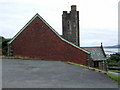
St Peter's church Wdig/Goodwick
Side view of the Gothic-style parish church which dominates the village and looks over to the bay. It was built in 1910 at considerable expense, with stone said to come from Ireland.
Image: © Natasha Ceridwen de Chroustchoff
Taken: 17 Aug 2007
0.05 miles
7
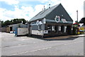
Little Green Planet, Goodwick
Wern Road heating supplies and installations business near Phoenix Park. Their website states that Little Green Planet took over from Goodwick Heating Centre Ltd and Stacks and Stoves which formerly concentrated on the installation of solid fuel stoves and solar thermal systems.
Image: © Jaggery
Taken: 6 Aug 2015
0.06 miles
8
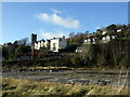
Site of former Dewhirst factory
The Dewhirst garment factory was a major local employer until it closed in 2002, the work being transferred to a cheaper overseas labour force. The factory stood empty for several years but has now been demolished - affording a clear view across to St Peter's church.
Image: © Natasha Ceridwen de Chroustchoff
Taken: 22 Dec 2009
0.06 miles
9
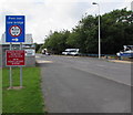
Low bridge sign, Goodwick
Alongside the A487 Wern Road on the approach to the Main Street junction and Duffryn railway bridge http://www.geograph.org.uk/photo/4601848 which has 4 metres (13' 3") headroom. Pont isel is Welsh for low bridge.
Image: © Jaggery
Taken: 6 Aug 2015
0.06 miles
10
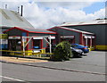
Hertz Car Rentals, Goodwick
Vehicle hire business, Wern Road.
Image: © Jaggery
Taken: 6 Aug 2015
0.07 miles