IMAGES TAKEN NEAR TO
Camrose, HAVERFORDWEST, SA62 6JL
Introduction
This page details the photographs taken nearby to SA62 6JL by members of the Geograph project.
The Geograph project started in 2005 with the aim of publishing, organising and preserving representative images for every square kilometre of Great Britain, Ireland and the Isle of Man.

There are currently over 7.5m images from over14,400 individuals and you can help contribute to the project by visiting https://www.geograph.org.uk
Image Map (Loading...)


Getting Data...Please wait
Leaflet Map data © OpenStreetMap
Images are licensed for reuse under creativecommons.org/licenses/by-sa/2.0
Notes
- Clicking on the map will re-center to the selected point.
- The higher the marker number, the further away the image location is from the centre of the postcode.
Image Listing (6 Images Found)
Images are licensed for reuse under creativecommons.org/licenses/by-sa/2.0
Image
Details
Distance
4
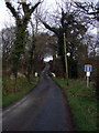
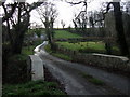
Leweston bridge and Claybogs Lane
A little bridge over a little stream; beyond, the road goes no further than Leweston, an agricultural hamlet.
The name of the lane - Claybogs - is doubtless descriptive of the surrounding terrain.
Image: © Natasha Ceridwen de Chroustchoff
Taken: 31 Dec 2009
0.16 miles
5
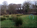
View near Leweston
Looking from Wolfsdale Hill towards Leweston bridge and Claybogs Lane which leads to Leweston Farm (out of sight).
Image: © Natasha Ceridwen de Chroustchoff
Taken: 31 Dec 2009
0.17 miles
6
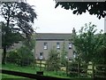
Wolfsdale Hill Farm
Looking south from Leweston Bridge. The farm stands on a road fork below the village of Wolfsdale.
Image: © Natasha Ceridwen de Chroustchoff
Taken: 31 Dec 2009
0.20 miles