IMAGES TAKEN NEAR TO
Wiston, HAVERFORDWEST, SA62 4PS
Introduction
This page details the photographs taken nearby to SA62 4PS by members of the Geograph project.
The Geograph project started in 2005 with the aim of publishing, organising and preserving representative images for every square kilometre of Great Britain, Ireland and the Isle of Man.

There are currently over 7.5m images from over14,400 individuals and you can help contribute to the project by visiting https://www.geograph.org.uk
Image Map (Loading...)


Getting Data...Please wait
Leaflet Map data © OpenStreetMap
Images are licensed for reuse under creativecommons.org/licenses/by-sa/2.0
Notes
- Clicking on the map will re-center to the selected point.
- The higher the marker number, the further away the image location is from the centre of the postcode.
Image Listing (178 Images Found)
Images are licensed for reuse under creativecommons.org/licenses/by-sa/2.0
Image
Details
Distance
1
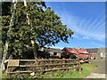
Long House Farm, Wiston
Pedigree Holsteins.
Image: © Alan Hughes
Taken: 7 Feb 2023
0.04 miles
2
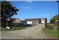
Longhouse Farm, Wiston
At the western end of Wiston.
Image: © Dylan Moore
Taken: 23 Oct 2016
0.04 miles
4
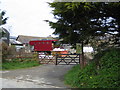
Longhouse Farm
Just west of Wiston village.
Image: © John Winterbottom
Taken: 23 Apr 2006
0.09 miles
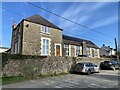
5
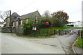
The old and new school buildings, Wiston
Image: © Humphrey Bolton
Taken: 27 Oct 2016
0.10 miles
6
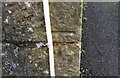
Ordnance Survey Cut Mark
This OS cut mark can be found on the south face of St Mary's Church Hall. It marks a point 109.579m above mean sea level.
Image: © Adrian Dust
Taken: 31 Mar 2017
0.10 miles
7
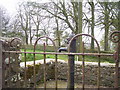
Wiston - old village pump in centre of road junction
Image: © welshbabe
Taken: 8 Apr 2016
0.13 miles
8
Wiston - old village pump in centre of road junction
Image: © welshbabe
Taken: 8 Apr 2016
0.13 miles
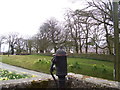
9
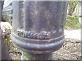
Wiston - old village pump in centre of road junction - detail
Image: © welshbabe
Taken: 8 Apr 2016
0.13 miles
10
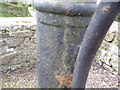
Wiston - old village pump in centre of road junction - detail
Image: © welshbabe
Taken: 8 Apr 2016
0.13 miles