
IMAGES TAKEN NEAR TO
St. Annes Head, Dale, HAVERFORDWEST, SA62 3RT
Introduction
This page details the photographs taken nearby to SA62 3RT by members of the Geograph project.
The Geograph project started in 2005 with the aim of publishing, organising and preserving representative images for every square kilometre of Great Britain, Ireland and the Isle of Man.

There are currently over 7.5m images from over14,400 individuals and you can help contribute to the project by visiting https://www.geograph.org.uk
Image Map
Images are licensed for reuse under creativecommons.org/licenses/by-sa/2.0
Notes
- Clicking on the map will re-center to the selected point.
- The higher the marker number, the further away the image location is from the centre of the postcode.
Image Listing (95 Images Found)
Images are licensed for reuse under creativecommons.org/licenses/by-sa/2.0
Image
Details
Distance

2
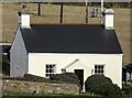
Veronica Cottage
*Mid C19 single-storey cottage, possibly built in association with the lighthouse.
A rural example of the mid C19 single-storeyed regional house, once common in Pembroke Dock, unaltered examples now rare.
A Grade II Listed Building.
*Courtesy Cadwr
Image: © Arthur C Harris
Taken: 22 Nov 2021
0.01 miles
3
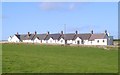
Row of coastguard cottages at St Ann's Head
Former coastguard cottages, now mostly holiday lets.
Image: © Gordon Hatton
Taken: 23 Oct 2013
0.02 miles
4

Pembrokeshire Potatoes
Planting Pembrokeshire potatoes at St Anne's Head.View to refineries on the Haven.
Image: © John Duckfield
Taken: 18 Apr 2010
0.02 miles
5
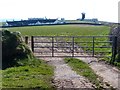
View towards St Ann's Head
On the left are former coastguard cottages and behind these are former lighthouse keepers cottages and the present lighthouse http://www.geograph.org.uk/photo/4408095 .
To the right is an early lighthouse http://www.geograph.org.uk/photo/4407509 .
Image: © Robin Drayton
Taken: 21 Mar 2015
0.02 miles
6
Houses at St Ann's Head, seen from the Castlemartin peninsula
Image: © Colin Bell
Taken: 15 Jun 2008
0.03 miles
7
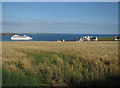
Coastguard Cottages, St Ann's Head
With a cruise ship leaving Milford Haven.
Image: © Hugh Venables
Taken: 4 Aug 2018
0.03 miles
8
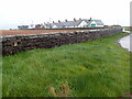
Houses at St Ann's Head
Originally for Trinity House officials now these are holiday accommodation. Note the holes in the boundary wall - these are rifle loopholes that would have been used to defend the Trinity House land from attack from the landward side during WW1.
Image: © Eirian Evans
Taken: 1 May 2022
0.04 miles
9
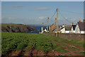
Down towards Mill Bay
With a row of coastguard cottages on the right, the land drops down towards Mill Bay and the waters of Milford Haven.
Image: © Stephen McKay
Taken: 23 Aug 2010
0.04 miles
10

St Ann's Head - loopholed wall (1)
-
Loopholed Wall: EDoB ID: e01374
The splayed loopholes at irregular intervals and height in the boundary wall at St Ann's Head date from the First World War. The rifle loopholes would have been used to defend Trinity House land from attack from the landward side. The defences were augmented with barbed wire and a minefield outside the wall during the Second World War.
Image
Image: © Mike Searle
Taken: 8 Jun 2021
0.06 miles