1
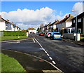
East side of The Close, Johnston
Looking north along The Close, an area of housing on the north side of Langford Road.
Image: © Jaggery
Taken: 18 Feb 2016
0.02 miles
2
Path to The Close, Johnston
Path from Langford Road to houses on the south side of The Close.
Image: © Jaggery
Taken: 18 Feb 2016
0.05 miles
3
The Close, Johnston
Part of an area of houses in The Close on the north side of Langford Road.
Image: © Jaggery
Taken: 18 Feb 2016
0.07 miles
4
J&J Motors, Johnston
New and used car dealership on the east side of the A4076 St Peter's Road.
Image: © Jaggery
Taken: 18 Feb 2016
0.07 miles
5
Cars for sale, Johnston
On display outside J&J Motors on the east side of the A4076 St Peter's Road.
Image: © Jaggery
Taken: 18 Feb 2016
0.07 miles
6
Langford Road bench and litter bin, Johnston
On the north side of Langford Road, near the junctions for Greenhall
Park (on the right) and The Close (in the background on the left).
Image: © Jaggery
Taken: 18 Feb 2016
0.07 miles
7
Iscoed, Johnston
Iscoed is the blue house on the east side of the A4076 St Peter's Road, the main road through Johnston.
Image: © Jaggery
Taken: 18 Feb 2016
0.07 miles
8
Greenhall Park towards Langford Road, Johnston
Looking NNW from a bend in the course of the Greenhall Park roadway.
Image: © Jaggery
Taken: 18 Feb 2016
0.08 miles
9
Bridge A4076 40, Johnston
The identifier A4076 40 is on the left side of the bridge carrying the A4076 St Peter's Road
over the West Wales Line railway immediately south of Johnston railway station.
Image: © Jaggery
Taken: 18 Feb 2016
0.09 miles
10
Langford Road bungalows, Johnston
On the north side of Langford Road, viewed from the Cranham Park junction.
Image: © Jaggery
Taken: 18 Feb 2016
0.09 miles


