IMAGES TAKEN NEAR TO
Church Close, HAVERFORDWEST, SA62 3AX
Introduction
This page details the photographs taken nearby to Church Close, SA62 3AX by members of the Geograph project.
The Geograph project started in 2005 with the aim of publishing, organising and preserving representative images for every square kilometre of Great Britain, Ireland and the Isle of Man.

There are currently over 7.5m images from over14,400 individuals and you can help contribute to the project by visiting https://www.geograph.org.uk
Image Map
Images are licensed for reuse under creativecommons.org/licenses/by-sa/2.0
Notes
- Clicking on the map will re-center to the selected point.
- The higher the marker number, the further away the image location is from the centre of the postcode.
Image Listing (78 Images Found)
Images are licensed for reuse under creativecommons.org/licenses/by-sa/2.0
Image
Details
Distance
1
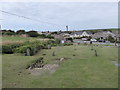
Glebe Lane
The junction between Gay Lane and Glebe Lane in Marloes.
Image: © Pebble
Taken: 29 May 2023
0.03 miles
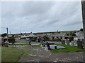
6
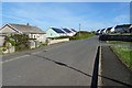
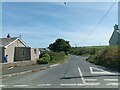
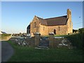
Bungalows in Marloes
Bungalows opposite ST Peter's church. The bungalows beyond the first one on the left have been newly built in recemt years. They don't appear on the 2011 Google Streetview.
Image: © Philip Halling
Taken: 14 May 2019
0.05 miles
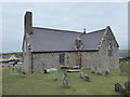
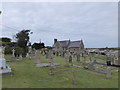
9
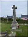
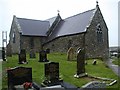
St Peter?s Church
Church in Marloes dedicated to St Peter.
Image: © Alan Hughes
Taken: 26 Jun 2019
0.06 miles