IMAGES TAKEN NEAR TO
Scotchwell Park, Cartlett, HAVERFORDWEST, SA61 2XF

Introduction

This page details the photographs taken nearby to Scotchwell Park, Cartlett, SA61 2XF by members of the Geograph project.

The Geograph project started in 2005 with the aim of publishing, organising and preserving representative images for every square kilometre of Great Britain, Ireland and the Isle of Man.

There are currently over 7.5m images from over14,400 individuals and you can help contribute to the project by visiting https://www.geograph.org.uk

Image Map


Images are licensed for reuse under creativecommons.org/licenses/by-sa/2.0
Notes
  • Clicking on the map will re-center to the selected point.
  • The higher the marker number, the further away the image location is from the centre of the postcode.

Image Listing (31 Images Found)

Images are licensed for reuse under creativecommons.org/licenses/by-sa/2.0
  • ...
Image
Details
Distance
1
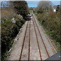
Two tracks into one NE of Haverfordwest railway station
Viewed from the A40 Narberth Road bridge. Most of the railway line in this area is single track. The twin tracks allow trains travelling in opposite directions to pass each other, though the current (April 2014) schedule of one passenger train every two hours in each direction means that there is usually never more than one train on the line between Haverfordwest and the terminus at Milford Haven. Haverfordwest railway station is about 350 metres behind the camera.
Image: © Jaggery Taken: 18 Apr 2014
0.05 miles
2
Scotchwell Lane houses, Haverfordwest
Scotchwell Lane is beyond the NE end of the street named Cartlett.
Image: © Jaggery Taken: 18 Apr 2014
0.06 miles
3
Railway junction north of the A40 bridge at Haverfordwest
Image: © Andy F Taken: 22 Sep 2009
0.07 miles
4
Cartlett Brook, Haverfordwest
Viewed from Scotchwell Lane.
Image: © Jaggery Taken: 18 Apr 2014
0.10 miles
5
Old Barn Opposite Bethany Farm
For sale. On the main A40 next to the Toyota garage
Image: © Deborah Tilley Taken: 24 Jan 2016
0.11 miles
6
A40 distances east of Haverfordwest
The sign alongside the A40 Narberth Road shows 21 (miles) to St Clears and 30 to Carmarthen.
Image: © Jaggery Taken: 18 Apr 2014
0.11 miles
7
A40 westbound
Image: © Alex McGregor Taken: 24 Apr 2014
0.12 miles
8
Culvert under the A40 Haverfordwest bypass
Before being blocked by the bypass this was a pleasant footpath by the Cartlett brook.
Image: © John Winterbottom Taken: 25 Apr 2006
0.12 miles
9
Railway NE of Haverfordwest station
Looking towards the A40 Narberth Road bridge from platform 1.
Image: © Jaggery Taken: 18 Apr 2014
0.13 miles
10
Holiday Information Centre, Haverfordwest
Viewed across the A40 Narberth Road.
Image: © Jaggery Taken: 18 Apr 2014
0.13 miles
  • ...