1
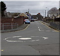
Tree-lined Coronation Avenue, Haverfordwest
Viewed from the corner of Back Lane.
Image: © Jaggery
Taken: 11 Mar 2019
0.02 miles
2
Path through Prendergast Cemetery, Haverfordwest
From Back Lane through the Haverfordwest Town Council municipal cemetery.
Image: © Jaggery
Taken: 11 Mar 2019
0.04 miles
3
Old cottage, Prendergast
This dilapidated cottage in Prendergast, the route leading into Haverfordwest from the north, looks as if it could be very old, judging by the cement-washed slate roof and the size of the door and windows - possibly one of the original dwellings here. It is to be hoped that the 'development' indicated on the sign will preserve its original features.
Image: © Natasha Ceridwen de Chroustchoff
Taken: 22 Dec 2006
0.05 miles
4
Tree-lined edge of Prendergast Cemetery, Haverfordwest
Haverfordwest Town Council municipal cemetery on the east side of Back Lane.
Image: © Jaggery
Taken: 11 Mar 2019
0.06 miles
5
Northwest side of Haverfordwest High VC School
The VC in the school name indicates a Voluntary Controlled School. Such schools must provide for all pupils to take part in a daily act of collective worship, which must reflect the broad traditions of Christian belief and be wholly Christian in character.
Image: © Jaggery
Taken: 11 Mar 2019
0.07 miles
6
Entrance to Prendergast Cemetery, Haverfordwest
From Back Lane into the Haverfordwest Town Council municipal cemetery.
Image: © Jaggery
Taken: 11 Mar 2019
0.08 miles
7
North along Back Lane, Haverfordwest
The entrance to Prendergast Cemetery https://www.geograph.org.uk/photo/6086836 is on the right.
Image: © Jaggery
Taken: 11 Mar 2019
0.08 miles
8
Bilingual school name sign, Haverfordwest
At the entrance from Back Lane to this https://www.geograph.org.uk/photo/6086882 school known as
Ysgol Uwchradd WR Hwlffordd in Welsh and
Haverfordwest High VC School in English.
Viewed in March 2019. The nameboard in an April 2011
Google Earth View shows Sir Thomas Picton School.
That school closed in 2018 when it merged with Tasker Milward
Voluntary Controlled School to form Haverfordwest High VC School.
Image: © Jaggery
Taken: 11 Mar 2019
0.08 miles
9
Pembrokeshire Archives/Archifdy Sir Benfro direction sign, Haverfordwest
The English/Welsh sign on the corner of Back Lane points this https://www.geograph.org.uk/photo/6086852 way.
Image: © Jaggery
Taken: 11 Mar 2019
0.08 miles
10
Back Lane mini-roundabout, Haverfordwest
Looking north along Back Lane towards Coronation Chippy https://www.geograph.org.uk/photo/6086828 on the left.
Image: © Jaggery
Taken: 11 Mar 2019
0.09 miles


