1
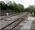
Railway to Milford Haven from Haverfordwest
Viewed from the SW edge of Haverfordwest railway station.
The two stations ahead are Johnston and the terminus at Milford Haven.
Image: © Jaggery
Taken: 18 Apr 2014
0.07 miles
2
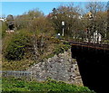
Railway from river bridge to road bridge, Haverfordwest
Viewed from the A4076 Freemans Way. The railway passes over a river,
the Western Cleddau, http://www.geograph.org.uk/photo/4017702 on the right and under New Road in the distance.
Haverfordwest railway station is about 350 metres beyond the New Road bridge.
Image: © Jaggery
Taken: 18 Apr 2014
0.08 miles
3
Ordnance Survey Cut Mark
This OS cut mark can be found on the NE parapet of the railway bridge on New Road. It marks a point 17.824m above mean sea level.
Image: © Adrian Dust
Taken: 13 Apr 2022
0.08 miles
4
Mill Ford Arms
Windsor Way behind; Salutation Square to the right.
Image: © Deborah Tilley
Taken: 16 Jul 2008
0.09 miles
5
Barrow crossing beyond Haverfordwest railway station
Viewed from the SW end of platform 1 in May 2018. Haverfordwest station on the Milford Haven branch of the West Wales line in Pembrokeshire is 100km west of Swansea. Next station ahead is Johnston https://www.geograph.org.uk/photo/4833524 on the route towards the line's terminus at Milford Haven.
Image: © Jaggery
Taken: 3 May 2018
0.09 miles
6
Cambrian Row
On the road to Uzmaston. Once a quiet road to a village a couple of miles away, it now overlooks a busy by-pass, Freemans Way.
Image: © Deborah Tilley
Taken: 19 Oct 2008
0.09 miles
7
Coast Aquatics, Cartlett, Haverfordwest
Aquarium installation, pond installation & home maintenance business near Haverfordwest railway station.
Image: © Jaggery
Taken: 3 May 2018
0.10 miles
8
WSW through Haverfordwest railway station
Viewed from the station footbridge. Next station ahead is Johnston on the route to Milford Haven.
Image: © Jaggery
Taken: 3 May 2018
0.10 miles
9
Behind the Mill Ford Arms
An ancient stone building sits parallel with the pub (which itself is very old). The newly revamped Popes Garage thrives in a competitive business after the previous busy owners retired.The main car in the picture is parked on Greens forecourt. (No longer selling petrol)
Image: © Deborah Tilley
Taken: 12 Jul 2008
0.10 miles
10
Cambrian Terrace
Looking to Freemans Way.
Image: © Deborah Tilley
Taken: 17 Aug 2008
0.10 miles


