IMAGES TAKEN NEAR TO
Snowdrop Lane, HAVERFORDWEST, SA61 1JD
Introduction
This page details the photographs taken nearby to Snowdrop Lane, SA61 1JD by members of the Geograph project.
The Geograph project started in 2005 with the aim of publishing, organising and preserving representative images for every square kilometre of Great Britain, Ireland and the Isle of Man.

There are currently over 7.5m images from over14,400 individuals and you can help contribute to the project by visiting https://www.geograph.org.uk
Image Map
Images are licensed for reuse under creativecommons.org/licenses/by-sa/2.0
Notes
- Clicking on the map will re-center to the selected point.
- The higher the marker number, the further away the image location is from the centre of the postcode.
Image Listing (11 Images Found)
Images are licensed for reuse under creativecommons.org/licenses/by-sa/2.0
Image
Details
Distance
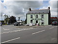
1
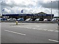
Day's Motor Park
At the corner of Haven Road and Dale Road.
Image: © Peter Whatley
Taken: 23 Jul 2009
0.02 miles
3
Jolly Jumpers
Day nursery in Haverfordwest.
Image: © Hugh Venables
Taken: 4 Aug 2018
0.05 miles
4
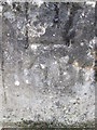
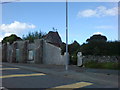
Ordnance Survey Cut Mark
This OS cut mark can be found on the cemetery gatepost on Portfield. It marks a point 67.438m above mean sea level.
Image: © Adrian Dust
Taken: 22 Aug 2015
0.06 miles
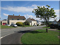
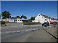
8
Nelson Villas in Snowdrop Lane
Once surrounded by countryside these cottages now have small businesses for company.
Image: © Deborah Tilley
Taken: 15 Aug 2008
0.11 miles
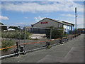
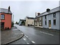
9
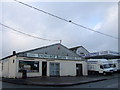
Bakery, Snowdrop Lane, Haverfordwest
Snowdrop Lane is in the outlying Scarrowscant area to the west of the town and contains a range of large commercial premises such as these with plenty of room for storage and parking.
Image: © Natasha Ceridwen de Chroustchoff
Taken: 28 Dec 2006
0.11 miles
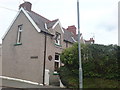
10
Ruin in Snowdrop Lane
A prime building plot that has been in this state for as long as I can remember.
Image: © Deborah Tilley
Taken: 22 Aug 2008
0.21 miles