IMAGES TAKEN NEAR TO
Carmarthen Road, SWANSEA, SA5 8LA

Introduction

This page details the photographs taken nearby to Carmarthen Road, SA5 8LA by members of the Geograph project.

The Geograph project started in 2005 with the aim of publishing, organising and preserving representative images for every square kilometre of Great Britain, Ireland and the Isle of Man.

There are currently over 7.5m images from over14,400 individuals and you can help contribute to the project by visiting https://www.geograph.org.uk

Image Map


Images are licensed for reuse under creativecommons.org/licenses/by-sa/2.0
Notes
  • Clicking on the map will re-center to the selected point.
  • The higher the marker number, the further away the image location is from the centre of the postcode.

Image Listing (16 Images Found)

Images are licensed for reuse under creativecommons.org/licenses/by-sa/2.0
Image
Details
Distance
1
Travellers Well Swansea
Pub at 554 Carmarthen Road in the Cwmdu area of Swansea. The name sign http://www.geograph.org.uk/photo/3671209 shows Est(ablished) 1832.
Image: © Jaggery Taken: 25 Sep 2013
0.05 miles
2
Travellers Well name sign, Swansea
The sign hangs from a frame here. http://www.geograph.org.uk/photo/3671205
Image: © Jaggery Taken: 25 Sep 2013
0.05 miles
3
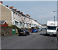
Megan Street Swansea
Viewed from the Carmarthen Road end looking towards Alice Street in the Cwmdu area of Swansea.
Image: © Jaggery Taken: 25 Sep 2013
0.06 miles
4
Kwit-Fit and Topps Tiles, Swansea
Two businesses alongside the A483 Carmarthen Road in the Cwmdu area of Swansea.
Image: © Jaggery Taken: 25 Sep 2013
0.09 miles
5
Mecca Bingo, Carmarthen Road, Swansea
Set back from the south side of the A483 Carmarthen Road.
Image: © Jaggery Taken: 25 Sep 2013
0.10 miles
6
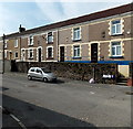
Cave Street Swansea
Viewed from the Carmarthen Road end. Not a survivor from Swansea's Fred Flintstone era, Cave Street was probably named after a person named Cave. There is a Cave Street in several other places in the UK, including Bristol, Hull and Oxford.
Image: © Jaggery Taken: 25 Sep 2013
0.12 miles
7
Ordnance Survey Cut Mark
This damaged OS cut mark can be found on No171 Middle Road. It marks a point 77.721m above mean sea level.
Image: © Adrian Dust Taken: 6 Jan 2014
0.13 miles
8
Wickes Extra in Swansea
Located in Heol Y Gors in the Cwmbwrla area of Swansea, the superstore measures 110 metres by 45 metres. Wickes sells DIY and home improvement products.
Image: © Jaggery Taken: 25 Sep 2013
0.13 miles
9
Ordnance Survey Cut Mark
This OS cut mark can be found on No242 Middle Road. It marks a point 94.134m above mean sea level.
Image: © Adrian Dust Taken: 17 Jan 2014
0.16 miles
10
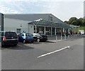
Aldi supermarket in Swansea
On the corner of Carmarthen Road and Heol y Cwmdu.
Image: © Jaggery Taken: 25 Sep 2013
0.18 miles