1
Village Pharmacy, Pontarddulais
Viewed from Pontarddulais railway station access road, on the east bank of the River Loughor.
Image: © Jaggery
Taken: 11 Feb 2015
0.01 miles
2
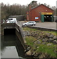
MOT garage on a riverbank, Pontarddulais
On the east bank of the River Loughor.
Image: © Jaggery
Taken: 11 Feb 2015
0.02 miles
3
Information boards, Pontarddulais
Alongside the A48 near the western boundary of Pontarddulais and the City and County of Swansea. A few tens of metres to the left, the River Loughor is the eastern boundary of Carmarthenshire. The board on the right shows Pontarddulais district history. The board on the left gives the history of nearby Pontarddulais railway station.
Image: © Jaggery
Taken: 11 Feb 2015
0.02 miles
4
Juxtaposed railway station sign and town name sign, Pontarddulais
Alongside the A48 on the east side of Loughor Bridge over the River Loughor, which here forms the boundary of Carmarthenshire to the left and the City and County of Swansea (formerly Glamorgan) on this side.
Image: © Jaggery
Taken: 11 Feb 2015
0.02 miles
5
MOT centre in a former railway building near Pontarddulais railway station
Located on the east bank of the River Loughor,
viewed from the Pontarddulais railway station access road.
Image: © Jaggery
Taken: 11 Feb 2015
0.02 miles
6
Pontarddulais railway station, Carmarthenshire
Opened as "Pontardulais" in 1850 by the "Llanelly" Railway, later part of the Great Western Railway, on the line from Llanelli to Llandeilo, the spelling was changed in 1980.
All the old buildings have now been swept away and four platforms reduced to one, as the station is no longer a junction. The only building remaining from an earlier age is the former goods shed.
Image: © Nigel Thompson
Taken: 17 May 2014
0.02 miles
7
Old-style livery bus enters Pontarddulais
In February 2015, First Bus single-decker 42681 is in the green and cream livery of the former Llanelly District Traction Company, which was taken over by South Wales Transport in 1952. The old-style livery celebrates 100 years of South Wales bus transport (1914-2014).
Image: © Jaggery
Taken: 11 Feb 2015
0.03 miles
8
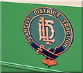
Llanelly District Traction crest on a First Cymru bus in 2015, Pontarddulais
See http://www.geograph.org.uk/photo/4415840 for a wider view and some details.
Image: © Jaggery
Taken: 11 Feb 2015
0.03 miles
9
Celebrating 100 years of South Wales bus services, Pontarddulais
In February 2015, First Bus single-decker 42681 is in the green and cream livery of the former Llanelly District Traction Company, http://www.geograph.org.uk/photo/4415844 which was taken over by South Wales Transport in 1952. The old-style livery celebrates 100 years of South Wales bus transport (1914-2014).
Image: © Jaggery
Taken: 11 Feb 2015
0.03 miles
10
Mrs Bucket in Pontarddulais
Commercial and domestic cleaning services office on the corner of St Teilo Street and Station Road.
Image: © Jaggery
Taken: 11 Feb 2015
0.03 miles


