IMAGES TAKEN NEAR TO
Mydroilyn, LAMPETER, SA48 7RJ
Introduction
This page details the photographs taken nearby to SA48 7RJ by members of the Geograph project.
The Geograph project started in 2005 with the aim of publishing, organising and preserving representative images for every square kilometre of Great Britain, Ireland and the Isle of Man.

There are currently over 7.5m images from over14,400 individuals and you can help contribute to the project by visiting https://www.geograph.org.uk
Image Map (Loading...)


Getting Data...Please wait
Leaflet Map data © OpenStreetMap
Images are licensed for reuse under creativecommons.org/licenses/by-sa/2.0
Notes
- Clicking on the map will re-center to the selected point.
- The higher the marker number, the further away the image location is from the centre of the postcode.
Image Listing (2 Images Found)
Images are licensed for reuse under creativecommons.org/licenses/by-sa/2.0
Image
Details
Distance
1
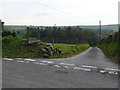
Blaenllanarth ger Caledrhydiau
Cyffordd ffordd ger Blaenllanarth / Road junction near Blaenllanarth
Image: © Ian Medcalf
Taken: 30 Oct 2008
0.18 miles
2
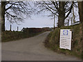
Entrance to Gafryw farm
Also where the CARA agricultural consultancy is to be found.
Image: © Nigel Brown
Taken: 14 Mar 2011
0.21 miles