IMAGES TAKEN NEAR TO
LLANARTH, SA47 0RG
Introduction
This page details the photographs taken nearby to SA47 0RG by members of the Geograph project.
The Geograph project started in 2005 with the aim of publishing, organising and preserving representative images for every square kilometre of Great Britain, Ireland and the Isle of Man.

There are currently over 7.5m images from over14,400 individuals and you can help contribute to the project by visiting https://www.geograph.org.uk
Image Map (Loading...)


Getting Data...Please wait
Leaflet Map data © OpenStreetMap
Images are licensed for reuse under creativecommons.org/licenses/by-sa/2.0
Notes
- Clicking on the map will re-center to the selected point.
- The higher the marker number, the further away the image location is from the centre of the postcode.
Image Listing (8 Images Found)
Images are licensed for reuse under creativecommons.org/licenses/by-sa/2.0
Image
Details
Distance
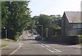
1
Ordnance Survey Cut Mark
This OS cut mark can be found on Chapel Fron Wen. It marks a point 121.877m above mean sea level.
Image: © Adrian Dust
Taken: 19 Sep 2015
0.12 miles
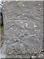
2
Ordnance Survey Cut Mark
This OS cut mark can be found on the west angle of the roadside barn at Pen Cwm Farm. It marks a point 120.504m above mean sea level.
Image: © Adrian Dust
Taken: 1 Jul 2021
0.17 miles
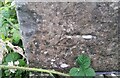
3
Ordnance Survey Cut Mark
This OS cut mark can be found on the house SE side of the road. It marks a point 105.495m above mean sea level.
Image: © Adrian Dust
Taken: 26 May 2021
0.20 miles
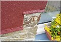
7
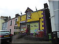
The Premier Central Stores in Llanarth, Ceredigion
Busy local shop, convenience store and social hub.
Image: © Jeremy Bolwell
Taken: 3 Mar 2019
0.22 miles