1
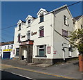
Gowerton Primary School, Gowerton
Viewed across Talbot Street.
Image: © Jaggery
Taken: 29 Sep 2013
0.04 miles
2
Gowerton: site of ex-LNW station
View eastward on A4295 High Street, at approximate former site of ex-LNW Gowerton ('South' from 1/50) station on the Pontardulais - Swansea Victoria section (closed 15/6/64) of the Central Wales line from Craven Arms, the subsequent 'Heart of Wales' trains running via Llanelli.
Image: © Ben Brooksbank
Taken: 22 Jun 2004
0.04 miles
3
Sunday morning cyclists in Gowerton
Heading east on Cecil Road.
Image: © Jaggery
Taken: 29 Sep 2013
0.05 miles
4
Mansel Workmen's Club, Gowerton
Viewed across Cecil Road.
Image: © Jaggery
Taken: 29 Sep 2013
0.08 miles
5
Sterry Road shops and a church, Gowerton
Temple United Reformed Church http://www.geograph.org.uk/photo/3677818 is on the right.
Image: © Jaggery
Taken: 15 Aug 2015
0.08 miles
6
The London & North Western (LNW) pub, Gowerton
Viewed across Sterry Road. Although deep within the area of the former Great Western Railway (GWR), Gowerton also had a London & North Western (LNW) presence for many years. Gowerton North (now Gowerton) station was on the GWR line between Swansea and Llanelli. Gowerton South (closed in 1964) was part of the LNW route from Pontarddulais to Swansea Victoria.
Image: © Jaggery
Taken: 29 Sep 2013
0.08 miles
7
The Contented Sole, Gowerton
Traditional fish and chips shop in Sterry Road. The LNW http://www.geograph.org.uk/photo/3678076 is next door.
Image: © Jaggery
Taken: 29 Sep 2013
0.08 miles
8
Temple URC Gowerton
Temple United Reformed Church is at 96 Sterry Road. The year 1899 is etched in stone above the doorway.
Image: © Jaggery
Taken: 29 Sep 2013
0.08 miles
9
Four No Entry signs, Talbot Street, Gowerton
Why are there four signs here, when two would suffice?
Image: © Jaggery
Taken: 29 Sep 2013
0.08 miles
10
Ordnance Survey Cut Mark
This OS cut mark can be found on the Hairdressers, No50 Sterry Road. It marks a point 20.403m above mean sea level.
Image: © Adrian Dust
Taken: 1 Jun 2014
0.08 miles


