1
Woodlands, Gowerton
A path following a former railway has been lost in new housing development, but the path now follows this slightly older residential road.
Image: © Bill Boaden
Taken: 6 Apr 2016
0.12 miles
2
Ordnance Survey Cut Mark
This OS cut mark can be found on the school wall. It marks a point 35.375m above mean sea level.
Image: © Adrian Dust
Taken: 13 Dec 2015
0.13 miles
3
Corwydd Road looking east
Image: © Colin Pyle
Taken: 22 Aug 2014
0.15 miles
4
Postbox and houses in Gorwydd Road Gowerton
Viewed across the B4295 Gorwydd Road.
Image: © Jaggery
Taken: 25 Sep 2013
0.16 miles
5
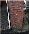
Ordnance Survey Cut Mark
This OS cut mark can be found on the wall post of No92 Gorwydd Road. It marks a point 23.339m above mean sea level.
Image: © Adrian Dust
Taken: 15 Feb 2023
0.17 miles
6
Ordnance Survey Cut Benchmark
Cut mark can be found on Left Hand Side pillar on 92 Gorwydd Road.
Image: © John Jenkins
Taken: 14 Feb 2023
0.17 miles
7
Tree-lined path between Gorwydd Road and Woodlands in Gowerton
Gorwydd Road is on the left. Houses in Woodlands (shown as Woodlands Terrace on one map) are out of shot on the right.
Image: © Jaggery
Taken: 25 Sep 2013
0.17 miles
8
Gowerton: site of ex-LNW station
View eastward on A4295 High Street, at approximate former site of ex-LNW Gowerton ('South' from 1/50) station on the Pontardulais - Swansea Victoria section (closed 15/6/64) of the Central Wales line from Craven Arms, the subsequent 'Heart of Wales' trains running via Llanelli.
Image: © Ben Brooksbank
Taken: 22 Jun 2004
0.18 miles
9
Gowerton Primary School, Gowerton
Viewed across Talbot Street.
Image: © Jaggery
Taken: 29 Sep 2013
0.19 miles
10
Gowerton South railway station (site), Glamorgan
Opened in 1867 as "Gower Road" by the Llanelly Railway, later part of the London & North Western Railway, on the line from Swansea Victoria to Pontardulais. The name was changed to "Gowerton" in 1886 and "Gowerton South" in 1950. The station closed in 1964.
View south east from the former track bed across the former level crossing towards the station site, also Dunvant and Swansea. The platforms began roughly where the car centre-right is, running into where the trees now are. The modern road ('Woodlands') in front of the trees cuts across the station site. Behind the camera position and to the right, the modern road continues on the alignment of the LNWR branch to Llanmorlais.
Image: © Nigel Thompson
Taken: 3 Sep 2015
0.19 miles


