IMAGES TAKEN NEAR TO
Carriers Lane, CARDIGAN, SA43 1FA

Introduction

This page details the photographs taken nearby to Carriers Lane, SA43 1FA by members of the Geograph project.

The Geograph project started in 2005 with the aim of publishing, organising and preserving representative images for every square kilometre of Great Britain, Ireland and the Isle of Man.

There are currently over 7.5m images from over14,400 individuals and you can help contribute to the project by visiting https://www.geograph.org.uk

Image Map


Images are licensed for reuse under creativecommons.org/licenses/by-sa/2.0
Notes
  • Clicking on the map will re-center to the selected point.
  • The higher the marker number, the further away the image location is from the centre of the postcode.

Image Listing (919 Images Found)

Images are licensed for reuse under creativecommons.org/licenses/by-sa/2.0
  • ...
Image
Details
Distance
1
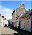
Carriers Lane
Part of the Cardigan one way system, the old building in the centre used to be the Cardigan and Tivyside Advertiser print room, now a listed building along with the offices in St Mary's Street round the corner.
Image: © chris whitehouse Taken: 12 Dec 2012
0.00 miles
2
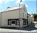
St. Mary's Street
Due to the road improvements years ago, this street was "cut in half", the right hand building was the offices of Cardigan and Tivyside Advertiser, further away the Angle Hotel. The street continues behind me up to the High Street.
Image: © chris whitehouse Taken: 12 Dec 2012
0.01 miles
3
Seyran's Pizza, Cardigan
Fast food takeaway (pizzas, kebabs, burgers, wraps etc) at 38 St Mary Street. Angel Hotel http://www.geograph.org.uk/photo/4543649 is next door.
Image: © Jaggery Taken: 26 Jun 2015
0.01 miles
4
Looking up St Mary's Street
Many of these old buildings have been attractively repainted and restored as part of Cardigan's regeneration scheme. The shop half way up on the left with the vertical white sign is the old custom house. For a view from the top looking down see Image
Image: © Natasha Ceridwen de Chroustchoff Taken: 21 Jan 2011
0.02 miles
5
Fred Rees & Son office in Cardigan
Independent family estate agency practice in Castle House, 42 St Mary Street.
Image: © Jaggery Taken: 26 Jun 2015
0.02 miles
6
Alley: Cardigan Castle
This connects the Castle Green with St Marys Street.
Image: © Dylan Moore Taken: 30 Jul 2015
0.02 miles
7
Play area: Cardigan Castle
Image: © Dylan Moore Taken: 30 Jul 2015
0.02 miles
8
Wolfs Gate Blue Plaque in Cardigan
Plaque on a wall at the junction of Morgan Street and St Mary Street.
Image: © Jeff Buck Taken: 27 Jun 2024
0.02 miles
9
Looking towards Morgan Street from Castle Green, Cardigan
Image: © Jeff Gogarty Taken: 2 Oct 2019
0.02 miles
10
Cardigan townscape
Typical of Cardigan's attractive jumble of buildings old and new, fitting together on different levels and preserving many old features like this wall. The stone building dominating the view is the old custom house of 1815, which controlled shipping all the way from Fishguard to Aberaeron, Cardigan being the major Welsh port at that time.
Image: © Natasha Ceridwen de Chroustchoff Taken: 19 Apr 2007
0.02 miles
  • ...