1
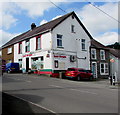
Local Bargain shop in Pencader
Convenience store on the corner of the B4459 and Station Road viewed in August 2019.
A July 2011 Google Street View shows Siop yr Albion, a Happy Shopper shop, here.
Image: © Jaggery
Taken: 1 Aug 2019
0.01 miles
2
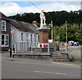
Pencader War Memorial
Grade II listed War Memorial in the centre of Pencader at the junction of the B4459 and Station Road.
https://www.geograph.org.uk/photo/6226070 to another view.
Image: © Jaggery
Taken: 1 Aug 2019
0.01 miles
3
Grade II listed Pencader War Memorial
In the centre of Pencader at the junction of the B4459 and Station Road. Grade II listed in 2003.
https://www.geograph.org.uk/photo/6226080 to another view.
Image: © Jaggery
Taken: 1 Aug 2019
0.01 miles
4
Detached house in Pencader
On the west side of the B4459, the main road through the village.
Viewed in August 2019. Older maps show a public house here.
Image: © Jaggery
Taken: 1 Aug 2019
0.01 miles
5
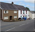
House and shop alongside the B4459 in Pencader
The house is next door to Local Bargain shop https://www.geograph.org.uk/photo/6226055 on the corner of Station Road.
Image: © Jaggery
Taken: 1 Aug 2019
0.01 miles
6
Mynwent/Cemetery direction sign in Pencader
Welsh/English sign facing the B4459 at the junction of the minor road to the cemetery.
Image: © Jaggery
Taken: 1 Aug 2019
0.02 miles
7
Junction in Pencader
Viewed across the B4459, the main road through Pencader.
TrawsCymru bus route T1 from Carmarthen uses the unclassified
road ahead. It leads to the A485 towards Lampeter.
Image: © Jaggery
Taken: 1 Aug 2019
0.02 miles
8
The War Memorial, Pencader
Quite an impressive memorial for a small village. The post office is behind.
Image: © Humphrey Bolton
Taken: 30 Sep 2007
0.03 miles
9
Bus stop, shelter and bench alongside a hedge, Pencader
A stop on TrawsCymru bus route T1 to Aberystwyth via Lampeter.
Image: © Jaggery
Taken: 1 Aug 2019
0.03 miles
10
Warning sign - Humps for 330 yards, Pencader
Alongside the B4459, the main road through Pencader. The text is also in Welsh.
Image: © Jaggery
Taken: 1 Aug 2019
0.03 miles


