IMAGES TAKEN NEAR TO
Chestnut Avenue, SWANSEA, SA3 5NJ
Introduction
This page details the photographs taken nearby to Chestnut Avenue, SA3 5NJ by members of the Geograph project.
The Geograph project started in 2005 with the aim of publishing, organising and preserving representative images for every square kilometre of Great Britain, Ireland and the Isle of Man.

There are currently over 7.5m images from over14,400 individuals and you can help contribute to the project by visiting https://www.geograph.org.uk
Image Map
Images are licensed for reuse under creativecommons.org/licenses/by-sa/2.0
Notes
- Clicking on the map will re-center to the selected point.
- The higher the marker number, the further away the image location is from the centre of the postcode.
Image Listing (14 Images Found)
Images are licensed for reuse under creativecommons.org/licenses/by-sa/2.0
Image
Details
Distance
1
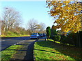
Chestnut Avenue, West Cross
The classic car is a 1966 Hillman Super Minx Series IV.
The moorland in Image is just beyond the hedge on the right of shot.
Image: © Jonathan Billinger
Taken: 12 Nov 2008
0.02 miles
2
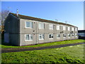
West Cross housing
This is on an estate on the hill above West Cross with views across Swansea Bay.
Note that there are reflections of the windows in the dew on the grass on this November morning.
Image: © Jonathan Billinger
Taken: 12 Nov 2008
0.05 miles
3
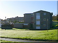
Low-rise flats
An estate on the hill above West Cross with views across Swansea Bay.
Image: © Jonathan Billinger
Taken: 12 Nov 2008
0.08 miles
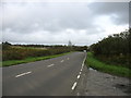
4
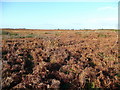
Gower moorland
Just west of the housing estates of The Mumbles.
Image: © Jonathan Billinger
Taken: 12 Nov 2008
0.14 miles
5
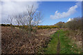
Path on the edge of Clyne Common
Unlike other paths on the common which are waterlogged, this path has a good solid base and is good to walk on.
Image: © Bill Boaden
Taken: 6 Apr 2016
0.17 miles
6
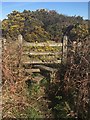
Stile at Clyne Common
Stile and Footpath leading onto Clyne Common.
Image: © Alan Hughes
Taken: 6 Apr 2017
0.18 miles
8
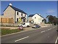
Mayals Road
New housing on B4436 on the outskirts of Mayals.
Image: © Alan Hughes
Taken: 19 Sep 2019
0.20 miles
9
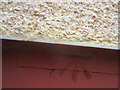
Ordnance Survey Cut Mark
This OS cut mark can be found on No66 Mulberry Avenue. It marks a point 65.017m above mean sea level.
Image: © Adrian Dust
Taken: 5 Mar 2014
0.21 miles
10
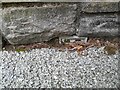
Ordnance Survey Flush Bracket (G3817)
This almost entirely buried OS Flush Bracket can be found on the garage of No199 Mayals Road.
Image: © Adrian Dust
Taken: 8 Dec 2022
0.21 miles