
IMAGES TAKEN NEAR TO
Picket Mead Road, SWANSEA, SA3 4SA
Introduction
This page details the photographs taken nearby to Picket Mead Road, SA3 4SA by members of the Geograph project.
The Geograph project started in 2005 with the aim of publishing, organising and preserving representative images for every square kilometre of Great Britain, Ireland and the Isle of Man.

There are currently over 7.5m images from over14,400 individuals and you can help contribute to the project by visiting https://www.geograph.org.uk
Image Map
Images are licensed for reuse under creativecommons.org/licenses/by-sa/2.0
Notes
- Clicking on the map will re-center to the selected point.
- The higher the marker number, the further away the image location is from the centre of the postcode.
Image Listing (27 Images Found)
Images are licensed for reuse under creativecommons.org/licenses/by-sa/2.0
Image
Details
Distance
1
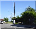
Communications mast by the main road through Newton
Image: © David Smith
Taken: 2 Jun 2018
0.07 miles
2
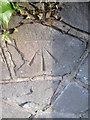
Ordnance Survey Cut Mark
This OS cut mark can be found on the wall of No8 Murton Lane. It marks a point 87.484m above mean sea level.
Image: © Adrian Dust
Taken: 9 Feb 2016
0.09 miles
3
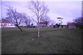
Picket Mead
Common land in Newton which has been subject to recent proposals to build houses on it. As far as I am aware, it is surviving, but the threat has not gone away completely. It is viewed here as daylight is fading.
Image: © Bill Boaden
Taken: 4 Apr 2016
0.10 miles
4
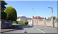
Neatly trimmed bushes and hedge, Lady Housty Avenue, Newton
Houses here are recorded as being among the most expensive in Wales
Image: © David Smith
Taken: 2 Jun 2018
0.10 miles
5
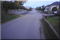
The end of the pavement on Murton Lane
Through Newton, Murton Lane has a reasonable width and pavements to walk on. This view shows this part having come off the narrow stretch between Newton and Manselfield where it is only one car width with no provision for pedestrians.
Image: © Bill Boaden
Taken: 4 Apr 2016
0.12 miles
6
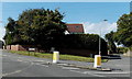
Eastern end of Murton Lane, Newton, Swansea
At the NW end of Newton Road, Murton Lane on the left
heads west away from the Highpool Lane junction on the right.
Image: © Jaggery
Taken: 12 Sep 2014
0.12 miles
7
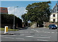
Highpool Lane, Newton, Swansea
At the NW end of Newton Road, the roadway splits
into Murton Lane http://www.geograph.org.uk/photo/4163404 on the left and Highpool Lane ahead.
Image: © Jaggery
Taken: 12 Sep 2014
0.13 miles
8
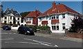
Highpool Lane houses, Newton, Swansea
Viewed across the NW end of Newton Road. The Manor House is in the background.
Image: © Jaggery
Taken: 12 Sep 2014
0.15 miles
9
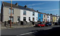
Row of houses, Newton Road, Newton, Swansea
The houses are at the NW end of Newton Road, near the Murton Lane/Highpool Lane junction.
Image: © Jaggery
Taken: 12 Sep 2014
0.17 miles
10
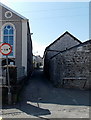
Narrow Summerland Lane, Newton, Swansea
A maximum width of 7' 0" is shown at the Newton Road end of Summerland Lane.
Paraclete Congregational Church http://www.geograph.org.uk/photo/4163336 is on the left.
Image: © Jaggery
Taken: 12 Sep 2014
0.18 miles