IMAGES TAKEN NEAR TO
Maesolbri, CARMARTHEN, SA33 5HE
Introduction
This page details the photographs taken nearby to Maesolbri, SA33 5HE by members of the Geograph project.
The Geograph project started in 2005 with the aim of publishing, organising and preserving representative images for every square kilometre of Great Britain, Ireland and the Isle of Man.

There are currently over 7.5m images from over14,400 individuals and you can help contribute to the project by visiting https://www.geograph.org.uk
Image Map
Images are licensed for reuse under creativecommons.org/licenses/by-sa/2.0
Notes
- Clicking on the map will re-center to the selected point.
- The higher the marker number, the further away the image location is from the centre of the postcode.
Image Listing (26 Images Found)
Images are licensed for reuse under creativecommons.org/licenses/by-sa/2.0
Image
Details
Distance
1
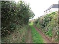
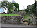
Hen Heol Llanybri Old Road
Hen heol werdd yn Llanybri.
Old green road in Llanybri.
Image: © Alan Richards
Taken: 21 Sep 2012
0.05 miles
2
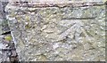
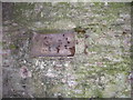
Ordnance Survey Cut Mark
This OS cut mark can be found on the wall post of Capel Newydd. It marks a point 103.010m above mean sea level.
Image: © Adrian Dust
Taken: 1 May 2017
0.06 miles
3
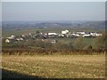
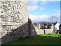
Llanybri
Llanybri village viewed from the South.
Image: © Peter Shaw
Taken: 28 Dec 2008
0.11 miles
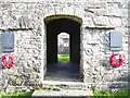
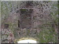
5
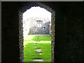
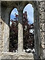
Hen Gapel, Llanybri
The ruins of Old Chapel in the village of Llanybri. An ancient church, last used as a Nonconformist chapel for over 200 years until 1960.
Image: © Gethin Evans
Taken: 4 Aug 2007
0.12 miles