IMAGES TAKEN NEAR TO
Llangynog, CARMARTHEN, SA33 5BX
Introduction
This page details the photographs taken nearby to SA33 5BX by members of the Geograph project.
The Geograph project started in 2005 with the aim of publishing, organising and preserving representative images for every square kilometre of Great Britain, Ireland and the Isle of Man.

There are currently over 7.5m images from over14,400 individuals and you can help contribute to the project by visiting https://www.geograph.org.uk
Image Map
Images are licensed for reuse under creativecommons.org/licenses/by-sa/2.0
Notes
- Clicking on the map will re-center to the selected point.
- The higher the marker number, the further away the image location is from the centre of the postcode.
Image Listing (9 Images Found)
Images are licensed for reuse under creativecommons.org/licenses/by-sa/2.0
Image
Details
Distance
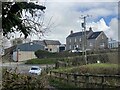
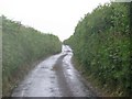
2
Road junction at Penplas
Cf Image] to see how different it looked 15 years ago.
Image: © Alan Hughes
Taken: 10 Apr 2023
0.02 miles
4

Cyffordd o heolydd bach / A junction of minor roads
Cyffordd o heolydd bach ger Ffarm Penplas.
A junction of minor roads near Penplas Farm (trans. top of the mansion / country house).
Image: © Alan Richards
Taken: 29 Dec 2022
0.04 miles
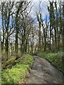
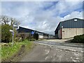
7
Another enclosed lane
Part of National Cycle Route 4 heading west from Carmarthen.
Image: © Colin Bell
Taken: 18 Jun 2008
0.15 miles
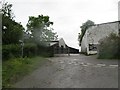
8
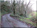
Tro yn yr heol / Bend in the road
Tro yn yr heol ger Llys Newydd. Ar y dde mae llwybr cyhoeddus yn gadael yr heol.
A bend in the road near Llys Newydd (trans. new court). A public footpath exits the road on the right.
Image: © Alan Richards
Taken: 29 Dec 2022
0.16 miles
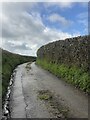
9
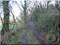
Llwybr ger Llys Newydd / Path near Llys Newydd
Llwybr cyhoeddus yn mynd drwy coedlan. Yn anffodus wrth ysgrifennu hyn mae'r llwybr wedi'i rwystro.
A public footpath heading through a copse. Unfortunately, at the time of writing the path is obstructed.
Image: © Alan Richards
Taken: 29 Dec 2022
0.24 miles