1
Stoneway Road, Laugharne
This appears to be the old road out of Laugharne to the south-west (note how it homes in on the market cross), later superseded by the present main road that reduces the gradient by curving round in a semi-circle. Stoneway road becomes an unsurfaced hollow-way further up, but the top end is now a housing estate road.
Image: © Humphrey Bolton
Taken: 2 Jul 2008
0.08 miles
2
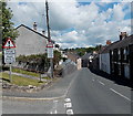
Warning signs in Laugharne
Two warning signs are on the corner of Gosport Street and Frogmore Gardens.
The one on the left shows that the road is liable to flooding. The sign on the right shows that Gosport Street narrows ahead. Oncoming vehicles may be in the middle of the road.
Image: © Jaggery
Taken: 21 Jul 2014
0.08 miles
3
Guest house in Gosport Street, Laugharne
There was no name visible here in July 2014 beyond a sign on the wall
showing B&B ensuite. Located opposite Frogmore Gardens.
Image: © Jaggery
Taken: 21 Jul 2014
0.08 miles
4
Laugharne: The A4066 running through the village
Image: © Michael Garlick
Taken: 10 Jun 2021
0.09 miles
5
Stone walls, Gosport Street, Laugharne
Stone walls here line both sides of the A4066 Gosport Street.
Set above road level, Rose Cottage is on the right.
Image: © Jaggery
Taken: 21 Jul 2014
0.09 miles
6
House by the shore, Laugharne
Quite a large double-pile house. The two halves appear to have floors on different levels.
Image: © Humphrey Bolton
Taken: 4 Oct 2007
0.10 miles
7
Gosport Street, Laugharne
Image: © Colin Pyle
Taken: 10 Dec 2012
0.10 miles
8
Frogmore Gardens bungalows, Laugharne
Viewed from Frogmore Street.
Image: © Jaggery
Taken: 21 Jul 2014
0.10 miles
9
Houses at the northern end of Gosport Street, Laugharne
The nameboard on the blue house showing The Boat House B&B, seen in
a Google Earth Street View taken in May 2011, was not here in July 2014.
Image: © Jaggery
Taken: 21 Jul 2014
0.11 miles
10
Cottages on The Strand - Laugharne
...... with rescue vessels in need of rescue!
Image: © Mick Lobb
Taken: 24 Jul 2012
0.11 miles


