IMAGES TAKEN NEAR TO
St. Catherine Street, CARMARTHEN, SA31 3DU
Introduction
This page details the photographs taken nearby to St. Catherine Street, SA31 3DU by members of the Geograph project.
The Geograph project started in 2005 with the aim of publishing, organising and preserving representative images for every square kilometre of Great Britain, Ireland and the Isle of Man.

There are currently over 7.5m images from over14,400 individuals and you can help contribute to the project by visiting https://www.geograph.org.uk
Image Map
Images are licensed for reuse under creativecommons.org/licenses/by-sa/2.0
Notes
- Clicking on the map will re-center to the selected point.
- The higher the marker number, the further away the image location is from the centre of the postcode.
Image Listing (369 Images Found)
Images are licensed for reuse under creativecommons.org/licenses/by-sa/2.0
Image
Details
Distance
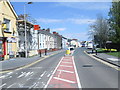
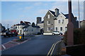
1
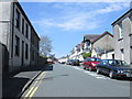
St David's Street - St Catherine Street
Image: © Betty Longbottom
Taken: 7 May 2013
0.01 miles
2
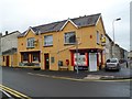
Carmarthen Camera Centre on St Catherine Street
Image: © Ian S
Taken: 21 Jan 2015
0.02 miles
3
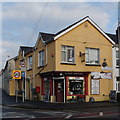
Carmarthen Camera Centre
On the corner of Parcmaen Street and St Catherine Street. Carmarthen Camera Centre Ltd was established in 1998, at the time specialising primarily in secondhand cameras and lenses. By 2003, the business had the largest selection of second hand cameras in Wales. The business now (2012) also sells new cameras (Canon Main Dealers) and has a vast range of photographic accessories in stock. Their usual reply to a customer query is "How many do you need" rather than "I can order it for you".
Image: © Jaggery
Taken: 3 Jun 2012
0.02 miles
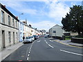
4
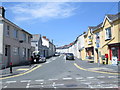
Parcmaen Street - St Catherine Street
Image: © Betty Longbottom
Taken: 7 May 2013
0.02 miles
5
St Catherine Street - viewed from Morfa Lane
Image: © Betty Longbottom
Taken: 7 May 2013
0.03 miles
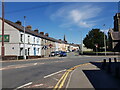
6
Lammas Street - viewed from Morfa Street
Image: © Betty Longbottom
Taken: 7 May 2013
0.04 miles
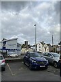
7
Lower end of Lammas Street, Carmarthen
Image: © Jeff Gogarty
Taken: 24 Apr 2021
0.04 miles
10
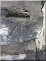
Ordnance Survey Cut Mark
This damaged OS cut mark can be found on the wall of No38 St Catherine Street. It marks a point 18.798m above mean sea level.
Image: © Adrian Dust
Taken: 25 Jan 2014
0.05 miles