1
Llwybr i Gwmoernant / Path to Cwmoernant
Llwybr cyhoeddus yn arwain at dreflan Cwmoernant.
A public footpath heading towards the hamlet of Cwmoernant (trans. valley of the cold stream).
Image: © Alan Richards
Taken: 9 Oct 2019
0.10 miles
2
Llwybr i Gwmoernant / Path to Cwmoernant
Llwybr cyhoeddus yn arwain at dreflan Cwmoernant.
A public footpath approaching the hamlet of Cwmoernant (trans. valley of the cold stream).
Image: © Alan Richards
Taken: 9 Oct 2019
0.12 miles
3
Ordnance Survey Cut Mark
This OS cut mark can be found on the gatepost of No6 Old Oak Lane. It marks a point 24.140m above mean sea level.
Image: © Adrian Dust
Taken: 25 Jan 2014
0.13 miles
4
Ordnance Survey Cut Mark
This OS cut mark can be found on the wall of No24 Richmond Terrace. It marks a point 22.969m above mean sea level.
Image: © Adrian Dust
Taken: 25 Jan 2014
0.15 miles
5
Ordnance Survey Cut Mark
This OS cut mark can be found on Penrhos House, Springfield Road. It marks a point 51.624m above mean sea level.
Image: © Adrian Dust
Taken: 1 Mar 2014
0.16 miles
6
Old Oak Lane, Carmarthen
From the A484 Priory Street, Old Oak Lane leads to Richmond Terrace.
Image: © Jaggery
Taken: 18 Nov 2019
0.16 miles
7
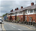
Richmond Cottages, Carmarthen
Located on the north side of Richmond Terrace, east of the Long Acre Road junction.
Image: © Jaggery
Taken: 30 May 2011
0.16 miles
8
Richmond Park School, Carmarthen
Viewed from Richmond Terrace through the school's perimeter fence.
Richmond Park is a primary school (for children aged 3 to 11).
Image: © Jaggery
Taken: 12 Aug 2012
0.16 miles
9
Corner of Old Oak Lane and Priory Street, Carmarthen
A yellow house with an orange front door dominates the corner of Old Oak Lane and Priory Street. Minor players on the Old Oak Lane side of the scene include a wall postbox and a Royal Mail pouch box, for temporary storage during a postman's or postwoman's delivery round.
Image: © Jaggery
Taken: 30 May 2011
0.17 miles
10
Amphitheatre Moridunum
Carmarthen was an important town in Roman times and the Romans built this amphitheatre for the purpose of holding gladiatorial shows and displays of wild beasts. Only part of the site is visible here because trees and bushes have been allowed to encroach on the far side. The local authority keeps the grass mown but does not provide any information for visitors.
Image: © Marion Phillips
Taken: 24 Apr 2008
0.18 miles


