IMAGES TAKEN NEAR TO
Priors Crescent, SWANSEA, SA2 7UP
Introduction
This page details the photographs taken nearby to Priors Crescent, SA2 7UP by members of the Geograph project.
The Geograph project started in 2005 with the aim of publishing, organising and preserving representative images for every square kilometre of Great Britain, Ireland and the Isle of Man.

There are currently over 7.5m images from over14,400 individuals and you can help contribute to the project by visiting https://www.geograph.org.uk
Image Map (Loading...)


Getting Data...Please wait
Leaflet Map data © OpenStreetMap
Images are licensed for reuse under creativecommons.org/licenses/by-sa/2.0
Notes
- Clicking on the map will re-center to the selected point.
- The higher the marker number, the further away the image location is from the centre of the postcode.
Image Listing (15 Images Found)
Images are licensed for reuse under creativecommons.org/licenses/by-sa/2.0
Image
Details
Distance
1
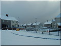
Entrance to Pen-Y-Fro Primary school
Pen-Y-Fro (Priors Crescent) in the snow!
Image: © ryme-intrinseca
Taken: 26 Feb 2004
0.03 miles
2
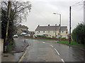
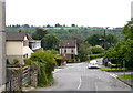
Killan Road junction with Priors Crescent
Image: © Stuart Logan
Taken: 23 Apr 2014
0.05 miles
4
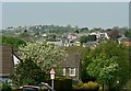
West Dunvant
West Dunvant, from Dunvant Road. The village of Three Crosses is on the skyline.
Image: © john bristow
Taken: 24 Apr 2020
0.13 miles
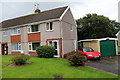
5
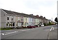
Terrace housing on Killan Road, Dunvant
Image: © john bristow
Taken: 28 Jun 2013
0.14 miles
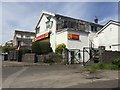
6
The village shop on Killan Road, Dunvant
Image: © john bristow
Taken: 28 Jun 2013
0.18 miles
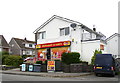
7
Dunvant Stores
Village store in Dunvant.
Image: © Alan Hughes
Taken: 15 May 2019
0.18 miles
8
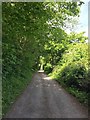
Lane in Dunvant
An old lane leading from Dunvant towards Gowerton.
Image: © Alan Hughes
Taken: 15 May 2019
0.20 miles
9
Fairwood Road in Dunvant
The buildings on the skyline are in Upper Killay
Image: © john bristow
Taken: 28 Jun 2013
0.22 miles
10
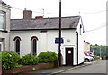
St. Martin's Church in Dunvant
This little church, which is a daughter church to St. Hilary's in Killay, was converted from a shop and was opened in 1949.
Image: © john bristow
Taken: 28 Jun 2013
0.22 miles