
IMAGES TAKEN NEAR TO
Averil Vivian Grove, SWANSEA, SA2 0JP
Introduction
This page details the photographs taken nearby to Averil Vivian Grove, SA2 0JP by members of the Geograph project.
The Geograph project started in 2005 with the aim of publishing, organising and preserving representative images for every square kilometre of Great Britain, Ireland and the Isle of Man.

There are currently over 7.5m images from over14,400 individuals and you can help contribute to the project by visiting https://www.geograph.org.uk
Image Map
Images are licensed for reuse under creativecommons.org/licenses/by-sa/2.0
Notes
- Clicking on the map will re-center to the selected point.
- The higher the marker number, the further away the image location is from the centre of the postcode.
Image Listing (31 Images Found)
Images are licensed for reuse under creativecommons.org/licenses/by-sa/2.0
Image
Details
Distance
1
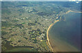
Swansea from the air, 1998
With the University at lower centre, and the docks by the mouth of the River Tawe. At top right, the River Neath meets the sea.
Image: © Derek Harper
Taken: 1 Jun 1998
0.09 miles
3
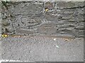
Ordnance Survey Cut Mark
This OS cut mark can be found on the wall NE side of Brynmill Lane. It marks a point 34.555m above mean sea level.
Image: © Adrian Dust
Taken: 19 Sep 2022
0.10 miles
4
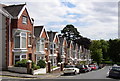
Knoll Avenue
This street is typical of the attractive terrace housing in the Brynmill area and also illustrates the hilly nature of much of Swansea.
Image: © john bristow
Taken: 27 Jul 2012
0.12 miles
5
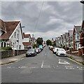
Knoll Avenue
Viewed from the north entrance to Brynmill Park.
Image: © Z Pryce
Taken: 18 Jun 2021
0.12 miles
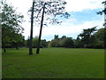
7
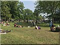
BBC Radio 1 Biggest Weekend 2018, Singleton Park
Image: © Bryn Holmes
Taken: 26 May 2018
0.13 miles
8
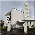
St Benedict's Catholic Church, Sketty
The entrance is on Llythrid Avenue, just off Sketty Road in the far eastern part of Sketty.
Image: © Z Pryce
Taken: 4 Oct 2021
0.14 miles
9

Ordnance Survey Cut Mark
This OS cut mark can be found on the gatepost to the south of Gower Road. It marks a point 48.024m above mean sea level.
Image: © Adrian Dust
Taken: 5 Dec 2013
0.14 miles
10
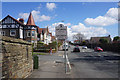
Sketty Road entering Uplands
The sign states that this was the birthplace of Dylan Thomas. The area is very proud of its connection with the poet, and this is not the only reference you will find.
Image: © Bill Boaden
Taken: 5 Apr 2016
0.14 miles