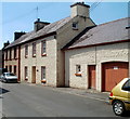
1
Ordnance Survey Flush Bracket 904
This can be found on the wall of a private dwelling in Llangadog.
For more detail see : http://www.bench-marks.org.uk/bm10019
Image: © Peter Wood
Taken: 20 Apr 2015
0.07 miles
2
Ordnance Survey Flush Bracket (904)
This OS Flush Bracket (904) can be found on what were the stables of the Bear Inn, Llangadog. It was used during the Second Geodetic Levelling of England & Wales (1912-21) Carmarthen - Llandovery Levelling Line. Also the Third Geodetic Levelling of England & Wales (1950-68) Llandovery - Carmarthen Levelling Line. It marks a point 177.4540ft above mean sea level.
Image: © Adrian Dust
Taken: 2 Jun 2013
0.08 miles
3
Heol Pendref houses, Llangadog
Viewed from the corner of Golwg-y-mynydd http://www.geograph.org.uk/photo/2516564 looking towards the A4069.
Image: © Jaggery
Taken: 3 Jul 2011
0.08 miles
4
Georgian Town House
Georgian Town House in Church Street, Llangadog.
Image: © Alan Hughes
Taken: 15 Aug 2019
0.09 miles
5
Grade II* listed Church House, Llangadog
Located in Church Street adjacent to the southern entrance to St Cadoc's churchyard.
The 3-storey house was built in the 18th century in a typical Georgian style.
Grade II* listed in August 1966.
Image: © Jaggery
Taken: 3 Jul 2011
0.09 miles
6
The Red Lion Coaching Inn, Llangadog
Located on the east side of Church Street, The Red Lion is part of the privately owned Cariad Inns Group which also owns The Kings Head http://www.geograph.org.uk/photo/3185830 in Llandovery and The Lamb & Flag http://www.geograph.org.uk/photo/3015809 in Rhayader.
Image: © Jaggery
Taken: 3 Jul 2011
0.09 miles
7
Llangadog, St Cadoc
Image: © Dave Kelly
Taken: 10 Aug 2022
0.09 miles
8
High Street houses, Llangadog
Looking towards Queen's Square and the Black Lion pub. http://www.geograph.org.uk/photo/2516290
Image: © Jaggery
Taken: 3 Jul 2011
0.09 miles
9
Entrance to the churchyard, Llangadog
Image: © Humphrey Bolton
Taken: 27 Apr 2019
0.09 miles
10
A4069 road sign, Llangadog
I was confused when I saw this road sign in Church Street. I was already on the A4069,
so wondered how both arms of the junction ahead were also the A4069.
The sign is correct. The explanation is that this part of the A4069 is a spur
(Church Street and Station Road) through Llangadog to the A40.
The main route of the A4069 is ahead.
Image: © Jaggery
Taken: 3 Jul 2011
0.09 miles


