IMAGES TAKEN NEAR TO
Penybanc, LLANDEILO, SA19 7TB
Introduction
This page details the photographs taken nearby to SA19 7TB by members of the Geograph project.
The Geograph project started in 2005 with the aim of publishing, organising and preserving representative images for every square kilometre of Great Britain, Ireland and the Isle of Man.

There are currently over 7.5m images from over14,400 individuals and you can help contribute to the project by visiting https://www.geograph.org.uk
Image Map (Loading...)


Getting Data...Please wait
Leaflet Map data © OpenStreetMap
Images are licensed for reuse under creativecommons.org/licenses/by-sa/2.0
Notes
- Clicking on the map will re-center to the selected point.
- The higher the marker number, the further away the image location is from the centre of the postcode.
Image Listing (4 Images Found)
Images are licensed for reuse under creativecommons.org/licenses/by-sa/2.0
Image
Details
Distance
1

Lane at Cefnrhiwlas
The farm occupies both sides of the lane.
Image: © Graham Horn
Taken: 20 Oct 2008
0.01 miles
2
Farmland near Cefnrhiwlas
A Vicon Lely, a farm implement for haymaking in a field near Cefnrhiwlas.
Image: © Philip Halling
Taken: 18 May 2014
0.08 miles
3

Wet cows above Cefnrhiwlas
We don't like this rain either.
Image: © Graham Horn
Taken: 20 Oct 2008
0.11 miles
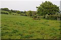
4

Wet field above Cefnrhiwlas
Even the sheep looks miserable.
Image: © Graham Horn
Taken: 20 Oct 2008
0.21 miles