IMAGES TAKEN NEAR TO
New Inn, LLANDEILO, SA19 7LF
Introduction
This page details the photographs taken nearby to SA19 7LF by members of the Geograph project.
The Geograph project started in 2005 with the aim of publishing, organising and preserving representative images for every square kilometre of Great Britain, Ireland and the Isle of Man.

There are currently over 7.5m images from over14,400 individuals and you can help contribute to the project by visiting https://www.geograph.org.uk
Image Map
Images are licensed for reuse under creativecommons.org/licenses/by-sa/2.0
Notes
- Clicking on the map will re-center to the selected point.
- The higher the marker number, the further away the image location is from the centre of the postcode.
Image Listing (9 Images Found)
Images are licensed for reuse under creativecommons.org/licenses/by-sa/2.0
Image
Details
Distance
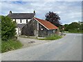
2
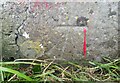
Ordnance Survey Cut Mark
This OS cut mark can be found on the barn NE side of the road. It marks a point 67.987m above mean sea level.
Image: © Adrian Dust
Taken: 8 Jun 2021
0.00 miles
3
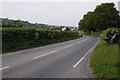
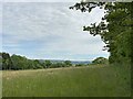
The B4302 near Rhosmaen
The B4302 near Rhosmaen to the north of Llandeilo.
Image: © Philip Halling
Taken: 18 May 2014
0.04 miles
4
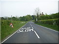
Araf/Slow on the B4302
The bilingual "Araf/Slow" road markings on B4302 heading for Rhosmaen and Llandeilo is just within the grid square.
Image: © Martyn Harries
Taken: 4 May 2011
0.04 miles
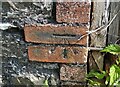
6
Ordnance Survey Cut Mark
This OS cut mark can be found on the gatepost of Bryncoed & Myrtwydd. It marks a point 64.603m above mean sea level.
Image: © Adrian Dust
Taken: 8 Jun 2021
0.17 miles
7
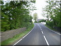
Approaching a bend on the B4302
Approaching a bend on the B4302 between Talley and Llandeilo near Salem.
Image: © Martyn Harries
Taken: 4 May 2011
0.18 miles
8
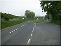
Lay-by on the B4302
Lay-by on the B4302 by the road junction to Pen-y-banc near Rhosmaen and New Inn.
Image: © Martyn Harries
Taken: 5 May 2011
0.20 miles
9
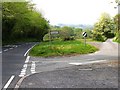
Road to Pen y Banc
The road junctions of B4302 and unclassified road leading to Pen y Banc.
Image: © John Atherton
Taken: 27 Apr 2007
0.23 miles