1
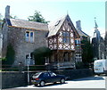
St David's RC church, Llandeilo
The Roman Catholic church occupies a converted former BT telephone exchange on Carmarthen Road. The first Mass in the new church was said on Palm Sunday, April 12th 1987.
Image: © Jaggery
Taken: 26 Jun 2011
0.01 miles
2
Yr Hen Vic, Llandeilo
Pub and restaurant at 82 New Road, viewed from the corner of Carmarthen Street.
Image: © Jaggery
Taken: 26 Jun 2011
0.02 miles
3
New Road in Llandeilo, Carmarthenshire
Ceffyl a thrap yn Llandeilo!
This is No 80 New Road in Llandeilo, circa 1908. Highly uncertain about the date. The large building on the left edge is now the Yr Hen Vic pub and restaurant, which receives good reviews!
The image is from my family archive. I think I know who the little girl in the trap is. What we need now is a new image. In the meantime:https://www.google.co.uk/maps/@51.8839007,-3.995571,3a,37.5y,288.18h,93.1t/data=!3m6!1e1!3m4!1smvNBVBEBxynyj_X03ZGSww!2e0!7i13312!8i6656
Image: © Unknown
Taken: Unknown
0.03 miles
4
Former provision market, Llandeilo
This is the southern corner of the former market, viewed across Carmarthen Street.
The provision market, built in 1838, served a wide area,
especially after the arrival of the railway in Llandeilo in 1852.
Image: © Jaggery
Taken: 26 Jun 2011
0.04 miles
5
Former Provisions Market
The signs suggest it is still on the market for a new owner. The market was opened in 1838.
Image: © John M
Taken: 6 Apr 2015
0.04 miles
6
Victorian Post Box on the Provisions Market Hall
Both of similar age but probably moved here quite recently.
Image: © John M
Taken: 6 Apr 2015
0.04 miles
7
Pili Pala Day Nursery, Llandeilo
The nursery occupies the former National School in Carmarthen Street.
Before local councils took over the running of schools c1870, church or chapel authorities were given responsibility for running primary school education. The National Society (Church of England) for Promoting Religious Education created a network of more than 5,000 schools in the UK which became known as National Schools. When it was founded in 1811, the National Society's aim was that the "national religion should be made the foundation of national education. Education for all, firmly based on the Christian Gospel and Anglican principles". Non-conformist chapels had a similar, though much smaller, network of schools run by the British and Foreign Schools Society, known as British Schools.
Image: © Jaggery
Taken: 26 Jun 2011
0.05 miles
8
31 Carmarthen Street, Llandeilo
Distinctively unlike neighbouring buildings, 31 Carmarthen Street
adjoins the former National School http://www.geograph.org.uk/photo/3270756 which is now a day nursery.
Image: © Jaggery
Taken: 26 Jun 2011
0.05 miles
9
Market Hall & Old Fire Station
There is an OS cut mark on the west angle, SW face. http://www.geograph.org.uk/photo/3573266
Image: © Adrian Dust
Taken: 28 Jul 2013
0.05 miles
10
Ambulance Station and an emergency ambulance, Llandeilo
Located on the north side of Carmarthen Road, next door to the fire station. http://www.geograph.org.uk/photo/3271814
Llandeilo Police Station http://www.geograph.org.uk/photo/3271828 is also nearby, on the opposite side of the road.
Image: © Jaggery
Taken: 26 Jun 2011
0.06 miles


