
IMAGES TAKEN NEAR TO
Kings Road, SWANSEA, SA1 8PL
Introduction
This page details the photographs taken nearby to Kings Road, SA1 8PL by members of the Geograph project.
The Geograph project started in 2005 with the aim of publishing, organising and preserving representative images for every square kilometre of Great Britain, Ireland and the Isle of Man.

There are currently over 7.5m images from over14,400 individuals and you can help contribute to the project by visiting https://www.geograph.org.uk
Image Map
Images are licensed for reuse under creativecommons.org/licenses/by-sa/2.0
Notes
- Clicking on the map will re-center to the selected point.
- The higher the marker number, the further away the image location is from the centre of the postcode.
Image Listing (164 Images Found)
Images are licensed for reuse under creativecommons.org/licenses/by-sa/2.0
Image
Details
Distance
1
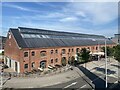
J-shed Warehouse, Prince Of Wales Dock, Swansea
Built c. 1895 on the east bank of the Tawe as a grain warehouse.
Image: © Alan Hughes
Taken: 21 Jun 2022
0.01 miles
2
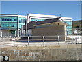
Norwegian Church Swansea Docks
Grade II listed former Norwegian Church originally located at Newport Docks was relocated to Swansea in 1910. The building comprises of a Seaman’s Mission to the west end and a single gothic church to the east end.
Image: © Andrew Davis
Taken: 19 Apr 2007
0.02 miles
3
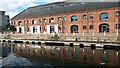
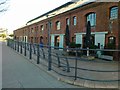
Converted warehouses at Prince of Wales Dock
Image: © David Martin
Taken: 24 Aug 2016
0.02 miles
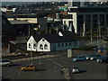
6
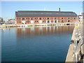
J Shed Swansea Docks
The J-Shed is an impressive Grade II listed former grain warehouse built circa 1895.
Image: © Andrew Davis
Taken: 19 Apr 2007
0.02 miles
7
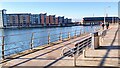
Prince of Wales Dock
The converted Prince of Wales dock in Swansea. One side of the dock is now repurposed into housing. In the distance, some of the original buildings can be seen - also now repurposed into modern office spaces.
Image: © Hywel Williams
Taken: 18 Dec 2021
0.02 miles
8
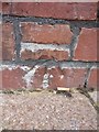
Ordnance Survey Cut Mark
This OS cut mark can be found on the building to the NE of Kings Road. It marks a point 6.646m above mean sea level.
Image: © Adrian Dust
Taken: 30 Oct 2013
0.03 miles
9
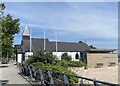
Norwegian Seamen?s Church
Now a children’s nursery, Appletree.
Image: © Alan Hughes
Taken: 21 Jun 2022
0.03 miles
10
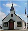
Norwegian Church, Swansea
Originally located at the Main Entrance to Swansea Docks, the landmark mission building was used extensively by Scandinavian seafarers for many decades, but their numbers had dwindled significantly by 1966 when the instruction came from Norway that the church should be closed. However, a Norwegian living in Pontarddulais, Mr. Eric Benneche, offered to take over the running of the mission and, with the aid of Swansea’s local Norwegian community, the church remained in use for another thirty two years until its eventual closure in 1998.
In 2004 the building was dismantled, restored and relocated to its present position next to ‘J’ Shed as part of Swansea’s SA1 redevelopment scheme.
Image: © Ann
Taken: 24 Jun 2009
0.03 miles