IMAGES TAKEN NEAR TO
Caerbryn, AMMANFORD, SA18 3DZ
Introduction
This page details the photographs taken nearby to SA18 3DZ by members of the Geograph project.
The Geograph project started in 2005 with the aim of publishing, organising and preserving representative images for every square kilometre of Great Britain, Ireland and the Isle of Man.

There are currently over 7.5m images from over14,400 individuals and you can help contribute to the project by visiting https://www.geograph.org.uk
Image Map
Images are licensed for reuse under creativecommons.org/licenses/by-sa/2.0
Notes
- Clicking on the map will re-center to the selected point.
- The higher the marker number, the further away the image location is from the centre of the postcode.
Image Listing (8 Images Found)
Images are licensed for reuse under creativecommons.org/licenses/by-sa/2.0
Image
Details
Distance
1
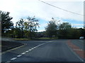
Llwybr yn gadael heol / Path exiting a road
Llwybr cyhoeddus yn gadael Heol Cae'rbryn.
A public footpath exiting Heol Cae'rbryn (trans. hill field road).
Image: © Alan Richards
Taken: 12 Aug 2020
0.03 miles
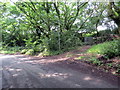
2
Llwybr yng Nghae'rlan / Path in Cae'rlan
Llwybr cyhoeddus ger pentref Cae'rlan yn mynd i gyfeiriad y B4556.
A public footpath near Cae'rlan village (trans. hill field) heading towards the B4556.
Image: © Alan Richards
Taken: 12 Aug 2020
0.08 miles
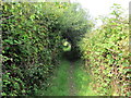
3
Llwybr Cae'r Bryn Path
Llwybr cyhoeddus yn arwain i gyfeiriad Cae'r Bryn.
A public footpath heading in the direction of Cae'r Bryn (trans. hill field).
Image: © Alan Richards
Taken: 9 Sep 2014
0.17 miles
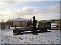
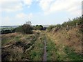
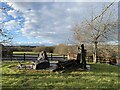
5
Cae'r-bryn Community Centre and monument
Image: © David Medcalf
Taken: 30 Sep 2007
0.22 miles
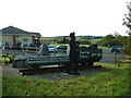
6
Mining memorial
Memorial at Cae’r Bryn.
Image: © Alan Hughes
Taken: 10 Feb 2021
0.23 miles
7
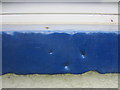
Ordnance Survey Pivot
This Ordnance Survey Pivot can be found on the window ledge of Waun Wyllt, Cae'r-bryn. It marks a point 116,8299m above mean sea level.
Image: © Adrian Dust
Taken: 16 Jun 2013
0.23 miles