IMAGES TAKEN NEAR TO
High Street, AMMANFORD, SA18 2ND
Introduction
This page details the photographs taken nearby to High Street, SA18 2ND by members of the Geograph project.
The Geograph project started in 2005 with the aim of publishing, organising and preserving representative images for every square kilometre of Great Britain, Ireland and the Isle of Man.

There are currently over 7.5m images from over14,400 individuals and you can help contribute to the project by visiting https://www.geograph.org.uk
Image Map (Loading...)


Getting Data...Please wait
Leaflet Map data © OpenStreetMap
Images are licensed for reuse under creativecommons.org/licenses/by-sa/2.0
Notes
- Clicking on the map will re-center to the selected point.
- The higher the marker number, the further away the image location is from the centre of the postcode.
Image Listing (17 Images Found)
Images are licensed for reuse under creativecommons.org/licenses/by-sa/2.0
Image
Details
Distance
1
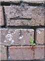
Ordnance Survey Cut Mark
This Ordnance Survey Cut Mark can be found on the wall between Nos 146 & 148 High Street. It marks a point 54.7850m above mean sea level.
Image: © Adrian Dust
Taken: 20 Jun 2013
0.04 miles
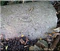
2
Ordnance Survey Cut Mark
This OS cut mark can be found on No46 Walter Road. It marks a point 55.16m above mean sea level.
Image: © Adrian Dust
Taken: 20 Sep 2020
0.07 miles
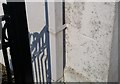
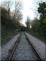
4
Ordnance Survey Rivet
This OS rivet can be found on the footbridge south side of High Street. It marks a point 46.570m above mean sea level.
Image: © Adrian Dust
Taken: 20 Sep 2020
0.11 miles
5
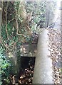
Overgrown Footbridge
South side of High Street
Image: © Adrian Dust
Taken: 20 Sep 2020
0.11 miles
8
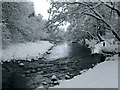
River Amman after snowfall
Looking downstream from just below some disused bridges. All the large rounded rocks on the shores have snow caps.
Image: © Nigel Davies
Taken: 17 Dec 2010
0.14 miles
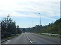
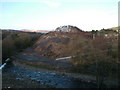
10
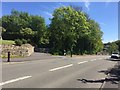
Pontaman Road
A474 Pontaman Road leading out of Ammanford.
Image: © Alan Hughes
Taken: 15 May 2018
0.18 miles