IMAGES TAKEN NEAR TO
Hopkinstown, AMMANFORD, SA18 2JJ
Introduction
This page details the photographs taken nearby to SA18 2JJ by members of the Geograph project.
The Geograph project started in 2005 with the aim of publishing, organising and preserving representative images for every square kilometre of Great Britain, Ireland and the Isle of Man.

There are currently over 7.5m images from over14,400 individuals and you can help contribute to the project by visiting https://www.geograph.org.uk
Image Map
Images are licensed for reuse under creativecommons.org/licenses/by-sa/2.0
Notes
- Clicking on the map will re-center to the selected point.
- The higher the marker number, the further away the image location is from the centre of the postcode.
Image Listing (3 Images Found)
Images are licensed for reuse under creativecommons.org/licenses/by-sa/2.0
Image
Details
Distance
1
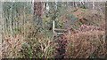
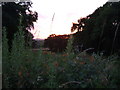
Right of way?
It appears that the owner of the house at the end of this little road is not too bothered about blocking the footpath with cut off oak branches. I had difficulty getting to the stile.
Image: © Marion Phillips
Taken: 19 Jan 2010
0.06 miles
2
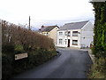
Ffordd Wernoleu
Hopkinstown or Trehopcyn in Welsh.
Image: © Marion Phillips
Taken: 19 Jan 2010
0.21 miles