1
St Ishmael
View of St Ishmael, on the East of the River Towy, taken from Llansteffan Castle on the West of the river Towy.
Image: © Cered
Taken: 29 Sep 2005
0.11 miles
2
Welsh stained glass window
St. Ishmael, the parish church of Ferryside has a fairly unusual stained glass window in that the inscriptions are in Welsh - something that's relatively rare.
The inscription comes in three parts - the angel on the top window carries the inscription "Eiddynt yw teyrnas nefoedd" (Theirs is the Kingdom of Heaven) and the two images beneath are captioned "Y Bugail Da" (The Good Shepherd) and "Duw cariad yw" (God is Love).
Beneath is the inscription (in English): "Lt. General Robert Christopher Mansel, Knight of Hannover, Colonel of the 68th Lt. Infantry who died April the 8th 1864 aged 75 and was buried near the camp at Shorncliffe where he so ably commanded for several years".
Image: © Hywel Williams
Taken: 27 Jul 2007
0.19 miles
3
Sundial on St Ishmaels Church Tower
Sundial just above the door of St Ishmaels Church, Near Ferryside, Carmarthen
Image: © Alan Harris
Taken: 25 Jul 2009
0.20 miles
4
St Ishmaels Church
View of St Ishmaels Church, Near Ferryside, Carmarthen
Image: © Alan Harris
Taken: 25 Jul 2009
0.20 miles
5
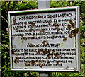
National Trust notice, St Ishmael
Located here. http://www.geograph.org.uk/photo/4572300 The notice is in Welsh and English, which states
OPEN TO THE PUBLIC SUBJECT TO THE BYLAWS ON THE BACK OF THIS NOTICE.
PLEASE KEEP YOUR DOG UNDER CONTROL AND PLEASE AVOID LIGHTING FIRES,
DAMAGING TREES, PLANTS, WALLS OR FENCES AND LEAVING LITTER.
Image: © Jaggery
Taken: 16 Jul 2015
0.21 miles
6
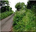
Track north into National Trust land, St Ishmael
Diverging from the coastal road from Kidwelly to Ferryside. A National Trust notice is ahead. http://www.geograph.org.uk/photo/4572315
Image: © Jaggery
Taken: 16 Jul 2015
0.21 miles
7
Public footpath sign, St Ishmael
Pointing across the coast road from Ferryside to Kidwelly, towards this track http://www.geograph.org.uk/photo/4572300 into National Trust land.
Image: © Jaggery
Taken: 16 Jul 2015
0.21 miles
8
A view across the graveyard at St Ishmael's Church
Image: © tristan forward
Taken: 2 Nov 2005
0.22 miles
9
Altar window
Stained glass window above the altar at St Ishmael’s Church.
Image: © Alan Hughes
Taken: 3 Aug 2020
0.22 miles
10
Hillside graveyard, St Ishmael
This part of the graveyard is on the north side of the Parish Church of St Isfael. http://www.geograph.org.uk/photo/4572626
Most of the graveyard is on the south side.
Image: © Jaggery
Taken: 16 Jul 2015
0.23 miles


