IMAGES TAKEN NEAR TO
Carlton Terrace, SWANSEA, SA1 6AE

Introduction

This page details the photographs taken nearby to Carlton Terrace, SA1 6AE by members of the Geograph project.

The Geograph project started in 2005 with the aim of publishing, organising and preserving representative images for every square kilometre of Great Britain, Ireland and the Isle of Man.

There are currently over 7.5m images from over14,400 individuals and you can help contribute to the project by visiting https://www.geograph.org.uk

Image Map


Images are licensed for reuse under creativecommons.org/licenses/by-sa/2.0
Notes
  • Clicking on the map will re-center to the selected point.
  • The higher the marker number, the further away the image location is from the centre of the postcode.

Image Listing (159 Images Found)

Images are licensed for reuse under creativecommons.org/licenses/by-sa/2.0
  • ...
Image
Details
Distance
1
Ordnance Survey Cut Mark
This OS cut mark can be found on a garage on Heathfield. It marks a point 42.303m above mean sea level.
Image: © Adrian Dust Taken: 31 Oct 2013
0.04 miles
2
Ordnance Survey Cut Mark
This OS cut mark can be found on the wall of No55 Mansel Street. It marks a point 22.793m above mean sea level.
Image: © Adrian Dust Taken: 29 Oct 2013
0.05 miles
3
Ordnance Survey Cut Mark
This OS cut mark can be found on the wall between No1 & No2 Calvert Terrace. It marks a point 24.649m above mean sea level.
Image: © Adrian Dust Taken: 16 Oct 2012
0.06 miles
4
Ordnance Survey Rivet
This OS rivet can be found on the wall of No144 Walter Road. It marks a point 22.186m above mean sea level.
Image: © Adrian Dust Taken: 29 Oct 2013
0.07 miles
5
Ordnance Survey Cut Mark
This OS cut mark can be found on the wall of No1 Chaddesley Villas. It marks a point 55.065m above mean sea level.
Image: © Adrian Dust Taken: 31 Oct 2013
0.09 miles
6
"Student Digz"
No prizes for guessing who lives in these terraced houses in Page Street nowadays.
Image: © Natasha Ceridwen de Chroustchoff Taken: 21 Oct 2009
0.10 miles
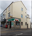
7
Walter Road Post Office, Swansea
At 12 Walter Road, on the corner of George Street.
Image: © Jaggery Taken: 27 Apr 2014
0.13 miles
8
Constitution Hill (1)
This celebrated street featured in the 1997 film 'Twin Town' for a car stunt - subsequent attempts by members of the public to replicate it have resulted in the street being closed to through traffic.
Image: © Natasha Ceridwen de Chroustchoff Taken: 21 Oct 2009
0.13 miles
9
Hanover Street
At its junction with Constitution Hill, a famous Swansea landmark which has recently been improved. The surrounding houses here on the slope of Townhill are on the whole rather shabby, many being multi-occupied. Hanover Street (formerly St George's Street) was the southern terminus of the short, and short-lived, cablecar tramway that run up and down Constitution Hill from 1898 to 1900 or thereabouts. See http://www.tramwayinfo.com/Tramframe.htm?http://www.tramwayinfo.com/Cards/Postc40.htm
Image: © Natasha Ceridwen de Chroustchoff Taken: 21 Oct 2009
0.13 miles
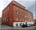
10
Northampton Lane side of the YMCA building, Swansea
Viewed across Page Street. Northampton Lane is on the left. The name inscribed above the doorway behind the cars is LLEWELYN HALL. http://www.geograph.org.uk/photo/4025986 to a front view of the YMCA building.
Image: © Jaggery Taken: 27 Apr 2014
0.13 miles
  • ...