1
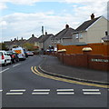
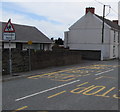
Row of houses, Stepney Road, Burry Port
The parked cars are opposite the Mansel Street junction.
Image: © Jaggery
Taken: 16 Mar 2018
0.04 miles
2
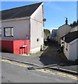
Cae Dolau, Burry Port
Dead-end road viewed across Pencoed Road.
Image: © Jaggery
Taken: 13 Mar 2018
0.04 miles
3
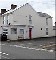
House on the corner of Stepney Road and Mansel Street, Burry Port
The house has the appearance of a converted former corner shop - a shop door
may once have been where the slightly recessed central ground floor window is now.
Image: © Jaggery
Taken: 16 Mar 2018
0.04 miles
4
Eastern end of Mansel Street, Burry Port
On the approach to the Stepney Road junction.
Image: © Jaggery
Taken: 13 Mar 2018
0.04 miles
5
Burry Port Junior Community School
Viewed across Stepney Road, Burry Port.
Image: © Jaggery
Taken: 15 Apr 2012
0.05 miles
6
Old school
Formerly a school, now Carmarthenshire Secondary Teaching and Learning Centre.
Image: © Alan Hughes
Taken: 16 Oct 2019
0.06 miles
7
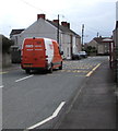
TNT Express van, Stepney Road, Burry Port
A subsidiary of FedEx, TNT Express is an international courier
delivery services company headquartered in Hoofddorp, Netherlands.
Image: © Jaggery
Taken: 16 Mar 2018
0.06 miles
8
Heol Elizabeth, Burry Port
Viewed from Pencoed Road. Some maps show Heol Elisabeth, but the street name sign disagrees.
Image: © Jaggery
Taken: 15 Apr 2012
0.07 miles
9
Welsh/English warning road sign, Stepney Road, Burry Port
The sign shows Patrol and the Welsh Hebryngwr.
Image: © Jaggery
Taken: 16 Mar 2018
0.07 miles
10
Our Lady Star of the Sea Catholic Church nameboard, Burry Port
The board on the right here https://www.geograph.org.uk/photo/5705648 shows that the church name is Ein Harglwyddes Seren y Môr in Welsh.
Image: © Jaggery
Taken: 13 Mar 2018
0.07 miles


