1
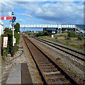
Towards Pembrey and Burry Port railway station
A view west along the West Wales Line from this http://www.geograph.org.uk/photo/3604460 level crossing. A signalbox http://www.geograph.org.uk/photo/3604445 is on the right.
Image: © Jaggery
Taken: 15 Apr 2012
0.04 miles
2
Gower Marine Services, Burry Port
Located on the corner of Ashburnham Road and an unnamed road from Burry Port Harbour.
Image: © Jaggery
Taken: 15 Apr 2012
0.05 miles
3
Railway footbridge, Burry Port
Viewed from Station Road. The footbridge over the West Wales Line railway leads to
Ashburnham Road. Pembrey and Burry Port railway station is nearby.
Image: © Jaggery
Taken: 15 Apr 2012
0.05 miles
4
Freight train approaching Burry Port station
Seen just from the overbridge north of the station a special train heads for west Wales.
Image: © roger geach
Taken: 21 Jun 1996
0.05 miles
5
English Methodist Church, Burry Port
Viewed across Glanmor Terrace.
The inscription in the lozenge above the doorway is Wesleyan Chapel 1866.
Image: © Jaggery
Taken: 15 Apr 2012
0.05 miles
6
From footbridge to footbridge, Burry Port
Looking eastwards along the West Wales line through Pembrey and Burry Port railway station from the station footbridge http://www.geograph.org.uk/photo/2900555 looking towards a footbridge http://www.geograph.org.uk/photo/3616976 from Station Road to Ashburnham Road.
Image: © Jaggery
Taken: 15 Apr 2012
0.05 miles
7
Red semaphore signal and a footbridge, Burry Port
A view east along the West Wales Line railway from the edge of a platform
at Pembrey and Burry Port railway station.
Image: © Jaggery
Taken: 15 Apr 2012
0.05 miles
8
Hapus Dyrfa nursery, Burry Port
Hapus Dyrfa is privately-owned day nursery, located in Cambrian House, Glanmor Terrace.
Image: © Jaggery
Taken: 15 Apr 2012
0.05 miles
9
Ordnance Survey Flush Bracket (S1157)
This OS Flush Bracket can be found on the north face of the Methodist Church. It marks a point 23.995ft above mean sea level.
Image: © Adrian Dust
Taken: 31 Oct 2017
0.06 miles
10
Leslie Griffiths Centre, Burry Port
Steps lead up to the recently-built Leslie Griffiths Centre, located at the back of the English Methodist Church. http://www.geograph.org.uk/photo/3603876 The Centre contains a modern meeting/conference room and adjacent kitchen facilities.
Image: © Jaggery
Taken: 15 Apr 2012
0.06 miles


