1
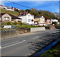
Cae Ffwrnes houses, Burry Port
On the east side of Cae Ffwrnes viewed from Gwscwm Road.
Image: © Jaggery
Taken: 16 Mar 2018
0.05 miles
2
Cae Ffwrnes, Burry Port
Cae Ffwrnes is a residential road on the south side of the A484 Gwscwm Road.
The green cabinet is a Western Power Distribution electricity substation.
Image: © Jaggery
Taken: 16 Mar 2018
0.06 miles
3
Roadside bench, Gwscwm Road, Burry Port
Alongside the A484 Gwscwm Road near the corner of Cae Ffwrnes.
Image: © Jaggery
Taken: 16 Mar 2018
0.08 miles
4
English-only road sign, Cae Ffwrnes, Burry Port
It was a surprise to see this sign showing Give Way in Carmarthenshire where Welsh is widely spoken and many street names are in Welsh only, such as Cae Ffwrnes. I expected to see a bilingual Ildiwch/Give Way sign similar to this one http://www.geograph.org.uk/photo/5691811 in Newport where Welsh is much less widely spoken.
Image: © Jaggery
Taken: 16 Mar 2018
0.09 miles
5
CK Foodstores, Gwscwm Road, Burry Port
A Nisa Local store set back from the north side of the A484 Gwscwm Road.
Image: © Jaggery
Taken: 16 Mar 2018
0.10 miles
6
Change of house type, Gwscwm Road, Burry Port
From bungalows to two-storey houses on the north side of the A484 Gwscwm Road.
Image: © Jaggery
Taken: 16 Mar 2018
0.11 miles
7
Ace Garage, Achddu, Burry Port
On the south side of the A484 Gwscwm Road near the corner of Bro Deri in the Achddu area of Burry Port.
Image: © Jaggery
Taken: 16 Mar 2018
0.12 miles
8
Gwscwm Park, Burry Port
Cul-de-sac on the south side of the A484 Gwscwm Road.
Image: © Jaggery
Taken: 16 Mar 2018
0.13 miles
9
Gwscwm Road houses, Achddu, Burry Port
Houses alongside a deadend side road on the north side of the A484 in the Achddu area of Burry Port.
Image: © Jaggery
Taken: 16 Mar 2018
0.13 miles
10
Houses on the north side of Gwscwm Road, Burry Port
Four semi-detached houses on the left - row of houses on the right.
Image: © Jaggery
Taken: 16 Mar 2018
0.13 miles


