IMAGES TAKEN NEAR TO
Walter Road, SWANSEA, SA1 5QQ

Introduction

This page details the photographs taken nearby to Walter Road, SA1 5QQ by members of the Geograph project.

The Geograph project started in 2005 with the aim of publishing, organising and preserving representative images for every square kilometre of Great Britain, Ireland and the Isle of Man.

There are currently over 7.5m images from over14,400 individuals and you can help contribute to the project by visiting https://www.geograph.org.uk

Image Map


Images are licensed for reuse under creativecommons.org/licenses/by-sa/2.0
Notes
  • Clicking on the map will re-center to the selected point.
  • The higher the marker number, the further away the image location is from the centre of the postcode.

Image Listing (120 Images Found)

Images are licensed for reuse under creativecommons.org/licenses/by-sa/2.0
  • ...
Image
Details
Distance
1
Ordnance Survey Rivet
This OS rivet can be found on the wall of No105A Walter Road. It marks a point 20.050m above mean sea level.
Image: © Adrian Dust Taken: 19 Nov 2013
0.02 miles
2
Memorial Baptist Chapel, Swansea
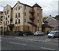
Located on the ground floor of a modern apartment building on the corner of Walter Road and Burman Street. The previous Memorial Baptist Church was demolished in 1992.
Image: © Jaggery Taken: 27 Apr 2014
0.02 miles
3
Swansea 4 Students, Walter Road, Swansea
The blue building is a student rental properties business at 117 Walter Road.
Image: © Jaggery Taken: 27 Apr 2014
0.04 miles
4
Murphy's Barber Shoppe in Swansea
On the corner of Walter Road and Duke Street, opposite The St George. http://www.geograph.org.uk/photo/3955670
Image: © Jaggery Taken: 27 Apr 2014
0.04 miles
5
The St George, Swansea
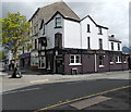
Pub on the corner of Walter Road and Duke Street.
Image: © Jaggery Taken: 27 Apr 2014
0.05 miles
6
Royal Welch Fusiliers Club and Social Club, Swansea
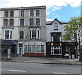
Viewed across the A4118 Walter Road. The St George pub http://www.geograph.org.uk/photo/3955670 is on the right.
Image: © Jaggery Taken: 27 Apr 2014
0.05 miles
7
Hanover Street, Swansea
White markings on the road surface delineate Permit Holders Only parking areas.
Image: © Jaggery Taken: 27 Apr 2014
0.07 miles
8
Ordnance Survey Cut Mark
This OS cut mark can be found on the wall between No152 & No153 Hanover Street. It marks a point 28.185m above mean sea level.
Image: © Adrian Dust Taken: 14 Nov 2013
0.07 miles
9
Duke Street, Swansea
Looking towards Brunswick Street from the corner of Russell Street.
Image: © Jaggery Taken: 27 Apr 2014
0.07 miles
10
Walter Road postboxes, Swansea
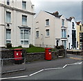
Located near the corner of Bullins Lane are twin postboxes for stamped mail and on the right a postbox for franked mail only.
Image: © Jaggery Taken: 27 Apr 2014
0.08 miles
  • ...