1
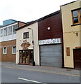
Avenue Villa Dental Surgery, Llanelli
Viewed across Queen Victoria Road.
Image: © Jaggery
Taken: 8 Apr 2012
0.03 miles
2
ATC, Lloyd Street, Llanelli
The initials ATC usually indicate the Air Training Corps,
but here it's a carpentry (Acorn Timber Craft) in Lloyd Street.
Image: © Jaggery
Taken: 8 Apr 2012
0.05 miles
3
"Greenfield Road" (Recreated)
This is a recreation of the following 1896 picture from the Frith collection: http://www.francisfrith.com/search/wales/dyfed/llanelli/photos/llanelli_38744.htm
The Frith collection describe this as Greenfield Road and indeed the chapel has Greenfield in its name stone, however there is no Greenfield Road here today. The church is on the corner of Murray Street and Station Road, with the photograph being taken in the middle of Queen Victoria Road.
The smaller chapel has been replaced by housing but the other buildings remain largely the same from 1896 to 2007.
Image: © Hywel Williams
Taken: 8 Jan 2007
0.05 miles
4
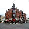
Llanelli Entertainment Centre
Located on the corner of Station Road and Queen Victoria Road.
This view was taken in April 2012. The local newspaper reported that the centre closed down in September 2012, to be replaced by a new Odeon cinema opening at East Gate the following month.
Image: © Jaggery
Taken: 8 Apr 2012
0.06 miles
5
Vista Lounge, Llanelli
Vista Lounge is in Castle Buildings on the corner of Murray Street and Station Road.
Image: © Jaggery
Taken: 8 Apr 2012
0.06 miles
6
Stepney Street (Recreated)
This is a recreation of the following 1957 picture from the Frith collection: http://www.francisfrith.com/search/wales/dyfed/llanelli/photos/llanelli_L73056.htm
The left hand side of the picture is definitely recognisable right down to the white square which has an advertisement on the 1957 picture. The right hand side of the picture is an entirely different story. I can remember this entire street being demolished when I was younger and a small park being put in its place which included a rather stark sunken garden. This sunken garden is currently being demolished by the council (or their subcontractors) - who knows what'll appear there next?
Image: © Hywel Williams
Taken: 10 Jan 2007
0.07 miles
7
Ordnance Survey Cut Mark
This OS cut mark can be found on Castle Buildings, at the junction of Station Road & Murray Street. Now the Vista Lounge. It marks a point 8.2418m above mean sea level.
Image: © Adrian Dust
Taken: 8 Feb 2014
0.07 miles
8
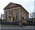
Greenfield Baptist Chapel, Llanelli
On the corner of Station Road and Murray Street. The large name tablet in the pediment shows the year 1858. Llanelli by the mid 1850s was developing both industrially and as a thriving port. There had been an influx of English-speaking families, mainly from the west of England, looking for work in the town's iron, steel and shipping industries. This church was built to meet their wishes to worship in English in a town where existing chapels held services in Welsh.
Image: © Jaggery
Taken: 8 Apr 2012
0.07 miles
9
Ordnance Survey Cut Mark (Remains)
This badly damaged OS cut mark can be found on the wall to the NW of Lloyd Street. It marked a point 8.5374m above mean sea level.
Image: © Adrian Dust
Taken: 8 Feb 2014
0.07 miles
10
Barnums pub for sale or to let, Llanelli
At the April 2012 date of the view, there was an estate agents' For Sale or To Let
board on the colourful pub on the corner of Station Road and Waterloo Street.
Image: © Jaggery
Taken: 8 Apr 2012
0.07 miles


