IMAGES TAKEN NEAR TO
St. Peters Terrace, LLANELLI, SA15 2RT

Introduction

This page details the photographs taken nearby to St. Peters Terrace, SA15 2RT by members of the Geograph project.

The Geograph project started in 2005 with the aim of publishing, organising and preserving representative images for every square kilometre of Great Britain, Ireland and the Isle of Man.

There are currently over 7.5m images from over14,400 individuals and you can help contribute to the project by visiting https://www.geograph.org.uk

Image Map


Images are licensed for reuse under creativecommons.org/licenses/by-sa/2.0
Notes
  • Clicking on the map will re-center to the selected point.
  • The higher the marker number, the further away the image location is from the centre of the postcode.

Image Listing (125 Images Found)

Images are licensed for reuse under creativecommons.org/licenses/by-sa/2.0
  • ...
Image
Details
Distance
1
Ordnance Survey Cut Mark
This OS cut mark can be found on the East angle of St Peter's Church. It marks a point 9.2141m above mean sea level.
Image: © Adrian Dust Taken: 27 Feb 2014
0.04 miles
2
Rolling Mill, Llanelli
Image: © Ronald John Saunders Taken: 4 Mar 2007
0.06 miles
3
Calvanistic Methodist Siloh Chapel
Lakefield Road.
Image: © Adrian Dust Taken: 27 Feb 2014
0.09 miles
4
Ordnance Survey Cut Mark
This OS cut mark can be found on the gatepost of Lakefield Road School. It marks a point 8.5253m above mean sea level.
Image: © Adrian Dust Taken: 27 Feb 2014
0.09 miles
5
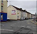
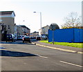
Railway Terrace, Llanelli
Viewed from Glanmor Road. A dark blue part of Once Upon a Time Day Nursery http://www.geograph.org.uk/photo/2890755 is on the left.
Image: © Jaggery Taken: 20 Aug 2015
0.10 miles
6
The Vine Inn, Llanelli
Located on the corner of Station Road and Pemberton Street, the Vine Inn looks disused in this view taken in April 2012. Signs on the wall have faded. The empty wall brackets formerly held flower baskets.
Image: © Jaggery Taken: 8 Apr 2012
0.11 miles
7
Railway at Llanelli
From the footbridge on Glanmor Terrace.
Image: © Wayland Smith Taken: 4 Sep 2021
0.12 miles
8
Glanmor Road, Llanelli
From Station Road along Glanmor Road towards George Street.
Image: © Jaggery Taken: 18 Nov 2019
0.12 miles
9
Start of the 20 zone, Glanmor Road, Llanelli
On the approach to a school, the 30mph speed limit drops to 20.
Image: © Jaggery Taken: 18 Nov 2019
0.13 miles
10
Three-storey housing on a Llanelli corner
Flats on the corner of Station Road and Marsh Street.
Image: © Jaggery Taken: 18 Nov 2019
0.13 miles
  • ...