1
Llanelli West signal box
Known as Llanelli West Ground Frame, the box controls the barriers at two level crossings,
one each end of Llanelli railway station. It is located just beyond the western edge
of the station, adjacent to the Glanmor Road level crossing.
Image: © Jaggery
Taken: 8 Apr 2012
0.03 miles
2
Glanmor Road level crossing, Llanelli
Looking south along Glanmor Road across the level crossing at the western edge of Llanelli railway station.
Image: © Jaggery
Taken: 8 Apr 2012
0.03 miles
3
Back view of Llanelli West Ground Frame
Viewed across Clos Glanmor. Originally a signal box, this is now a ground frame used to control the barriers at two level crossing, one at each end of Llanelli railway station. The two windows on this side of the building have been bricked up. http://www.geograph.org.uk/photo/2890787 to a front view.
Image: © Jaggery
Taken: 8 Apr 2012
0.03 miles
4
Barriers down, Glanmor Road level crossing, Llanelli
A westbound train has just arrived at Llanelli railway station, on the east (right) side of the level crossing. The barriers are down and the red lights are flashing in readiness for the passage of the train http://www.geograph.org.uk/photo/2890885 across the road in a couple of minutes.
Once Upon a Time Day Nursery http://www.geograph.org.uk/photo/2890755 is on the left.
Image: © Jaggery
Taken: 8 Apr 2012
0.03 miles
5
Train approaches Glanmor Road level crossing, Llanelli
At the western edge of Llanelli station, an Arriva Trains Wales train is about to cross
Glanmor Road level crossing. http://www.geograph.org.uk/photo/2890872 The leading unit is number 153312.
Image: © Jaggery
Taken: 8 Apr 2012
0.03 miles
6
Looking west from Llanelli railway station
A view from platform 2 looking past the Glanmor Road level crossing. http://www.geograph.org.uk/photo/2890797 towards Llanelli West Ground Frame. http://www.geograph.org.uk/photo/2890787
A small sign in the middle of the view, between the tracks, shows SHUNT LIMIT.
Image: © Jaggery
Taken: 8 Apr 2012
0.03 miles
7
Great Western Terrace, Llanelli
Dead-end street extending for 85 metres from Copperworks Road, on the south side of Llanelli railway station.
Image: © Jaggery
Taken: 6 Aug 2015
0.03 miles
8
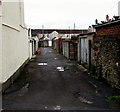
Llanelli back alley
Looking west across the northern branch of Copperworks Road near the corner of Great Western Terrace.
Image: © Jaggery
Taken: 6 Aug 2015
0.03 miles
9
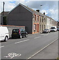
Cycle route marking on Copperworks Road, Llanelli
Painted depiction of a bicycle near the George Street junction. http://www.geograph.org.uk/photo/4615641
Image: © Jaggery
Taken: 15 Aug 2015
0.03 miles
10
George Street, Llanelli
Looking across Copperworks Road along George Street towards Glanmor Road.
Image: © Jaggery
Taken: 15 Aug 2015
0.05 miles


